MyTopo
Lingshire NW Montana US Topo Map
Couldn't load pickup availability
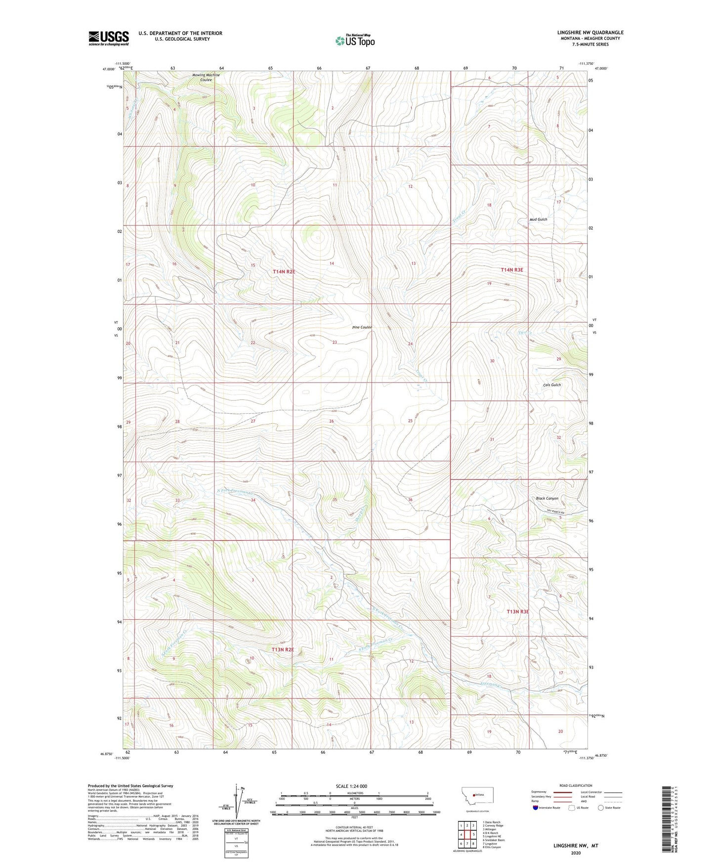
2024 topographic map quadrangle Lingshire NW in the state of Montana. Scale: 1:24000. Based on the newly updated USGS 7.5' US Topo map series, this map is in the following counties: Meagher. The map contains contour data, water features, and other items you are used to seeing on USGS maps, but also has updated roads and other features. This is the next generation of topographic maps. Printed on high-quality waterproof paper with UV fade-resistant inks.
Quads adjacent to this one:
West: B K Ranch
Northwest: Dana Ranch
North: Conway Ridge
Northeast: Millegan
East: Lingshire NE
Southeast: Ellis Canyon
South: Lingshire
Southwest: Snedaker Basin
This map covers the same area as the classic USGS quad with code o46111h4.
Contains the following named places: Flint Post Office, Flint School, Mowing Machine Coulee, North Fork Freeman Creek, Sheep Creek, South Fork Freeman Creek, Whitetail Creek