MyTopo
Three Buttes Creek West Montana US Topo Map
Couldn't load pickup availability
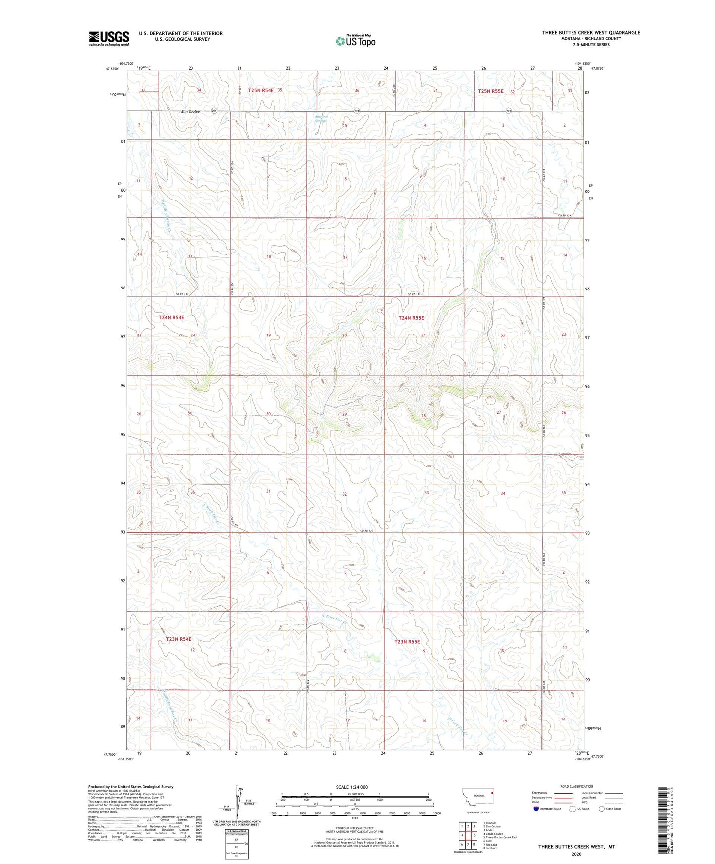
2024 topographic map quadrangle Three Buttes Creek West in the state of Montana. Scale: 1:24000. Based on the newly updated USGS 7.5' US Topo map series, this map is in the following counties: Richland. The map contains contour data, water features, and other items you are used to seeing on USGS maps, but also has updated roads and other features. This is the next generation of topographic maps. Printed on high-quality waterproof paper with UV fade-resistant inks.
Quads adjacent to this one:
West: Carda Coulee
Northwest: Elmdale
North: Elm Coulee
Northeast: Andes
East: Three Buttes Creek East
Southeast: Lambert
South: Fox Lake
Southwest: Enid
This map covers the same area as the classic USGS quad with code o47104g6.
Contains the following named places: 23N54E11ACDD01 Well, 24N54E12ADCB01 Well, 24N54E23DABB01 Well, 24N55E04DADD01 Well, 24N55E33ACCD01 Well, 59243, Antelope Springs, Bradley School, Lambert Division, V E G Gunderson Dam, Vaira Dam