MyTopo
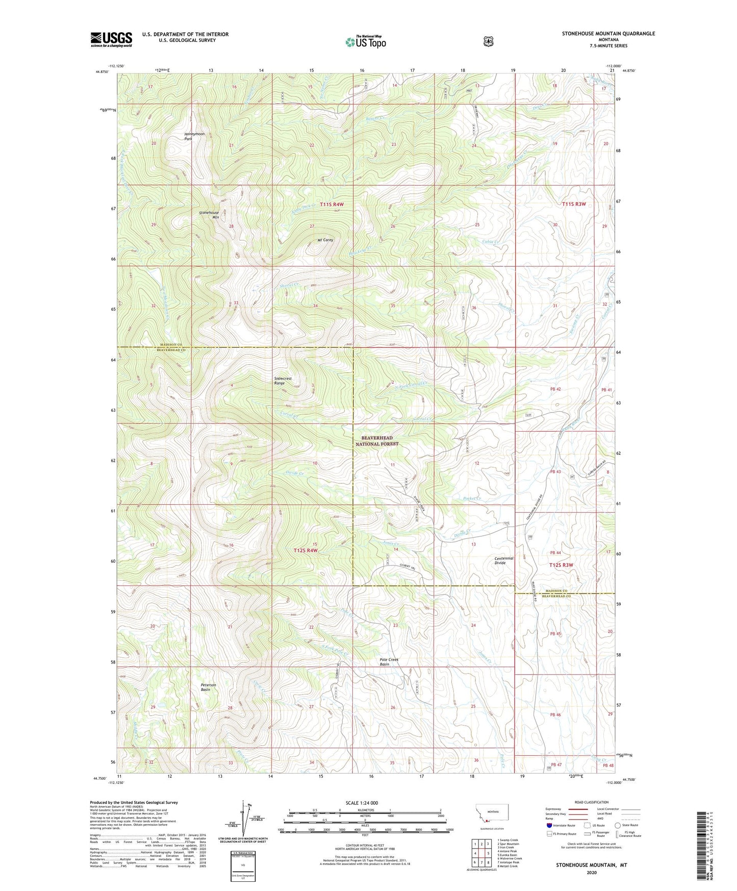
Stonehouse Mountain Montana US Topo Map
Couldn't load pickup availability
Also explore the Stonehouse Mountain Forest Service Topo of this same quad for updated USFS data
2024 topographic map quadrangle Stonehouse Mountain in the state of Montana. Scale: 1:24000. Based on the newly updated USGS 7.5' US Topo map series, this map is in the following counties: Madison, Beaverhead. The map contains contour data, water features, and other items you are used to seeing on USGS maps, but also has updated roads and other features. This is the next generation of topographic maps. Printed on high-quality waterproof paper with UV fade-resistant inks.
Quads adjacent to this one:
West: Antone Peak
Northwest: Swamp Creek
North: Spur Mountain
Northeast: Iron Creek
East: Eureka Basin
Southeast: Metzel Creek
South: Antelope Peak
Southwest: Wolverine Creek
This map covers the same area as the classic USGS quad with code o44112g1.
Contains the following named places: Andy Dick Creek, Cabin Creek, Centennial Divide, Divide Creek, Divide Creek Guard Station, Gilbert Trail, Hawkeye Creek, Honeymoon Park, Jones Creek, Mount Carey, North Fork Corral Creek, Peterson Basin, Pocket Creek, Pole Creek Basin, Snowcrest Trail, South Fork Pole Creek, Stonehouse Mountain, Swamp Creek