MyTopo
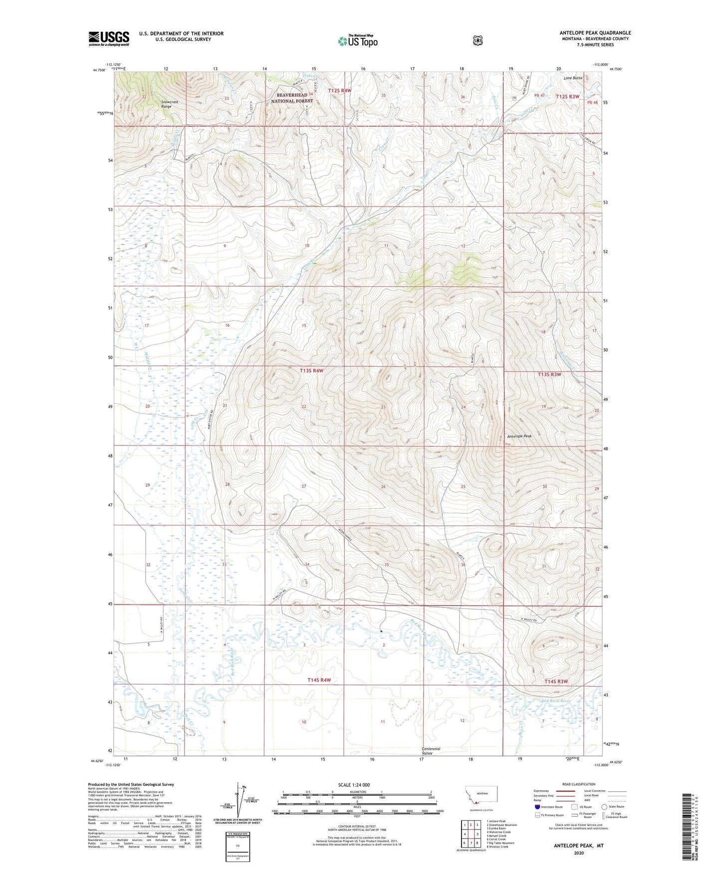
Antelope Peak Montana US Topo Map
Couldn't load pickup availability
Also explore the Antelope Peak Forest Service Topo of this same quad for updated USFS data
2024 topographic map quadrangle Antelope Peak in the state of Montana. Scale: 1:24000. Based on the newly updated USGS 7.5' US Topo map series, this map is in the following counties: Beaverhead. The map contains contour data, water features, and other items you are used to seeing on USGS maps, but also has updated roads and other features. This is the next generation of topographic maps. Printed on high-quality waterproof paper with UV fade-resistant inks.
Quads adjacent to this one:
West: Wolverine Creek
Northwest: Antone Peak
North: Stonehouse Mountain
Northeast: Eureka Basin
East: Metzel Creek
Southeast: Winslow Creek
South: Big Table Mountain
Southwest: Corral Creek
This map covers the same area as the classic USGS quad with code o44112f1.
Contains the following named places: 13S04W17BCDA01 Well, 13S04W28CDDB01 Well, Antelope Peak, Bean Creek, Crow Creek, Duffner Ranch, Lone Butte, Long Creek, Middle Creek, Mohican Creek, Peet Creek, Piute Creek, Pole Creek