MyTopo
Ksanka Peak Montana US Topo Map
Couldn't load pickup availability
Also explore the Ksanka Peak Forest Service Topo of this same quad for updated USFS data
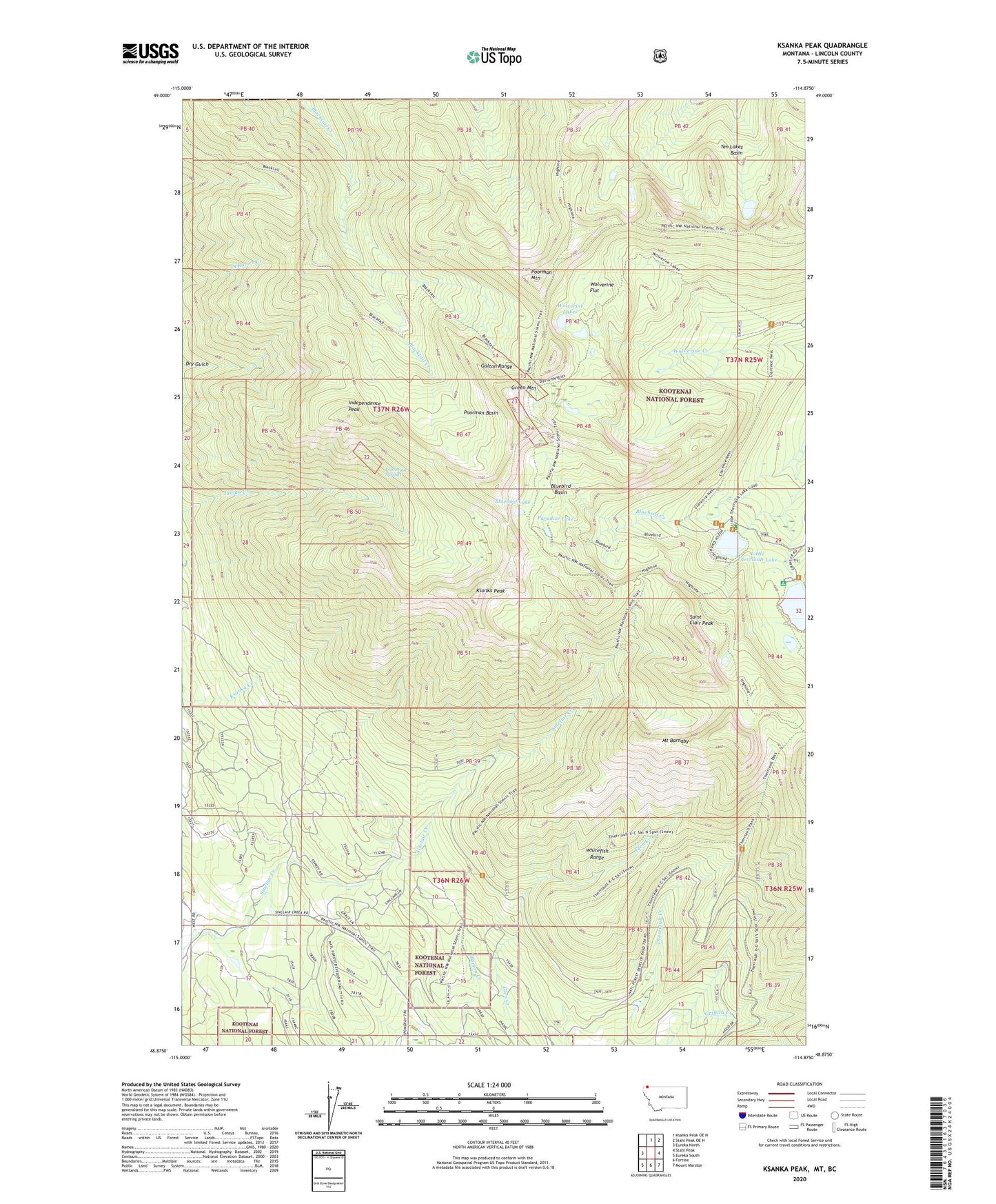
2024 topographic map quadrangle Ksanka Peak in the state of Montana. Scale: 1:24000. Based on the newly updated USGS 7.5' US Topo map series, this map is in the following counties: Lincoln. The map contains contour data, water features, and other items you are used to seeing on USGS maps, but also has updated roads and other features. This is the next generation of topographic maps. Printed on high-quality waterproof paper with UV fade-resistant inks.
Quads adjacent to this one:
West: Eureka North
North: Ksanka Peak OE N
Northeast: Stahl Peak OE N
East: Stahl Peak
Southeast: Mount Marston
South: Fortine
Southwest: Eureka South
This map covers the same area as the classic USGS quad with code o48114h8.
Contains the following named places: Big Therriault Campground, Big Therriault Lake, Bluebird Basin, Bluebird Cabin, Bluebird Lake, Dry Gulch, Galton Range, Green Mountain, Independence Mine, Independence Peak, Ksanka Peak, Lemonade Springs, Little Therriault Lake, Little Therriault Lake Campground, Mount Barnaby, Paradise Lake, Poorman Basin, Poorman Mountain, Saint Clair Peak, Ten Lakes Basin, Ten Lakes Scenic Area, Twin Peaks Mine, Wolverine Flat, Wolverine Lakes, ZIP Code: 59917