MyTopo
Fallon NE Montana US Topo Map
Couldn't load pickup availability
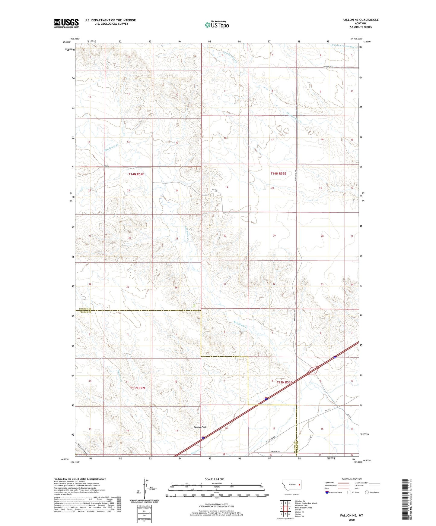
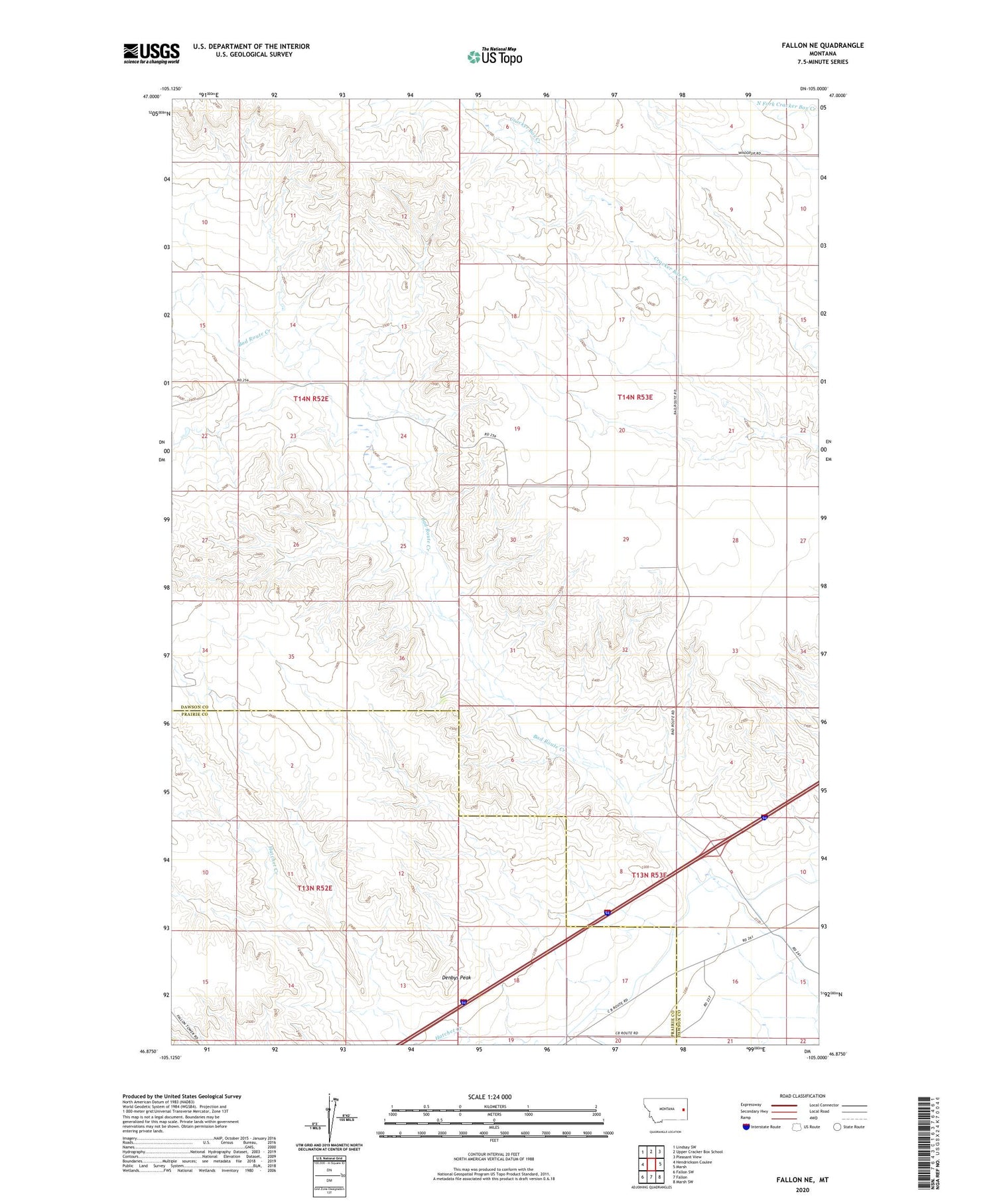
2020 topographic map quadrangle Fallon NE in the state of Montana. Scale: 1:24000. Based on the newly updated USGS 7.5' US Topo map series, this map is in the following counties: Dawson, Prairie. The map contains contour data, water features, and other items you are used to seeing on USGS maps, but also has updated roads and other features. This is the next generation of topographic maps. Printed on high-quality waterproof paper with UV fade-resistant inks.
Quads adjacent to this one:
West: Hendrickson Coulee
Northwest: Lindsay SW
North: Upper Cracker Box School
Northeast: Pleasant View
East: Marsh
Southeast: Marsh SW
South: Fallon
Southwest: Fallon SW
Contains the following named places: 13N53E04CABA01 Well, 13N53E07BDDD01 Well, 13N53E09DAD_01 Well, 13N53E09DDCD01 Well, 13N53E10CBB_01 Well, 13N53E10CCC_01 Well, 13N53E15BAA_01 Well, 13N53E15BBA_01 Well, 13N53E15BCA_01 Well, 13N53E15BDC_01 Well, 13N53E15CAB_02 Well, 13N53E15CAB_03 Well, 13N53E15CCB_01 Well, 13N53E16BAA_01 Well, 13N53E16BDB_01 Well, 13N53E16CDBC01 Well, 13N53E16DDB_01 Well, 13N53E17AAA_01 Well, 13N53E17ADB_01 Well, 13N53E17CCD_01 Well, 13N53E17DCBC01 Well, 13N53E18ABAA01 Well, 14N52E24CBCA01 Well, 14N52E34DBCD01 Well, 14N52E34DBCD02 Well, 14N53E04CACC01 Well, 14N53E04CBDD01 Well, 14N53E20DDA_01 Well, Amo School, Denbys Peak, Glendive West Rest Area, Hatchet Creek School, Morris Post Office, Yellowstone River Historical Marker