MyTopo
Fishtail Montana US Topo Map
Couldn't load pickup availability
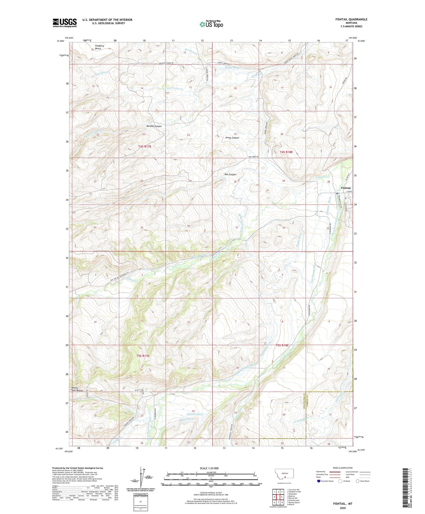
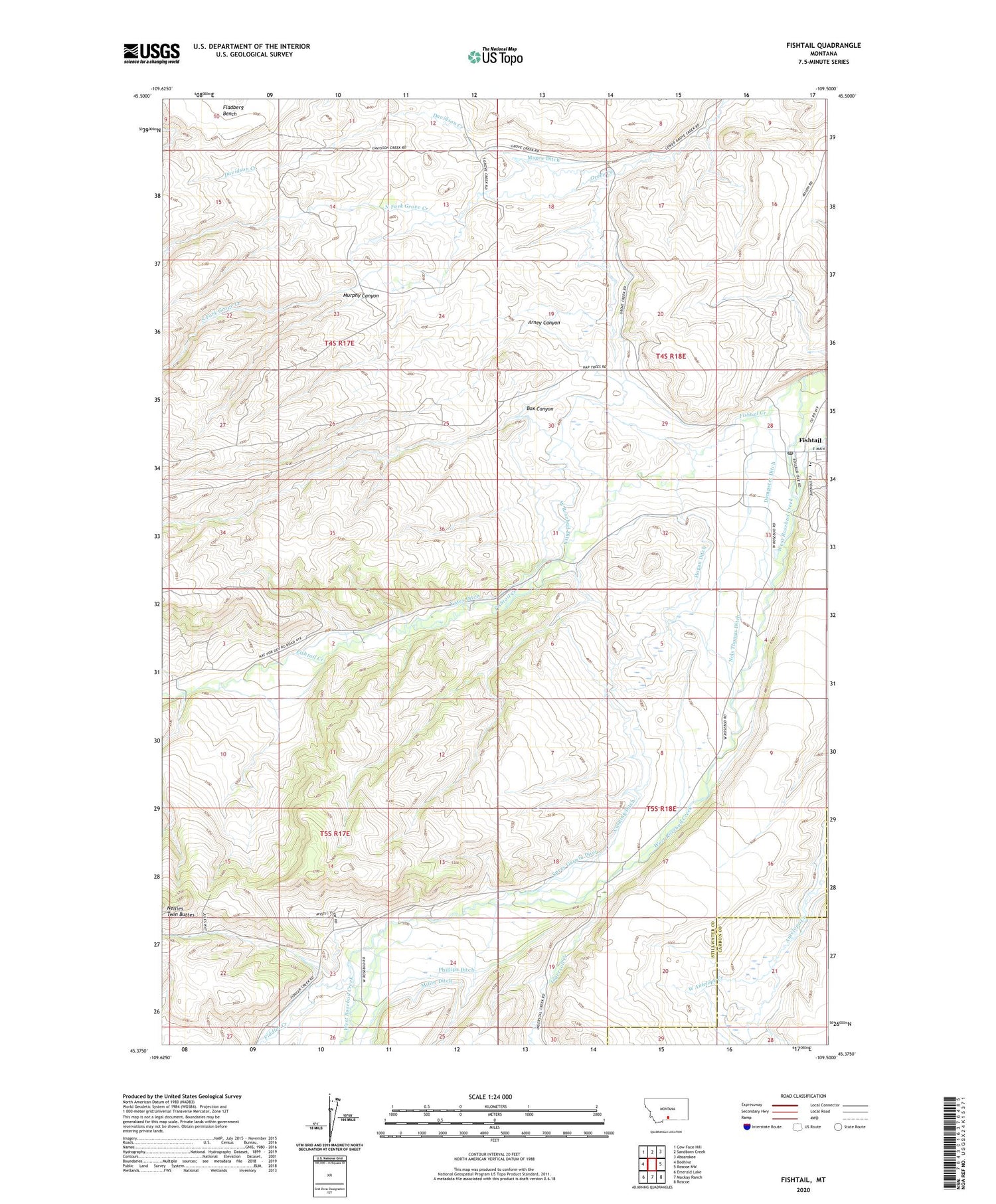
2020 topographic map quadrangle Fishtail in the state of Montana. Scale: 1:24000. Based on the newly updated USGS 7.5' US Topo map series, this map is in the following counties: Stillwater, Carbon. The map contains contour data, water features, and other items you are used to seeing on USGS maps, but also has updated roads and other features. This is the next generation of topographic maps. Printed on high-quality waterproof paper with UV fade-resistant inks.
Quads adjacent to this one:
West: Beehive
Northwest: Cow Face Hill
North: Sandborn Creek
Northeast: Absarokee
East: Roscoe NW
Southeast: Roscoe
South: Mackay Ranch
Southwest: Emerald Lake
Contains the following named places: 04S18E18ADAA01 Well, 04S18E20CCCC01 Well, 04S18E28CABB01 Well, 04S18E28DADD01 Well, 04S18E28DCAA01 Well, 04S18E32BCDC01 Well, 05S17E02CBBD01 Well, 05S17E13CDDB01 Well, 05S17E23ABBC01 Well, 05S18E04CBDC01 Well, 05S18E06BBBD01 Well, 05S18E17DAAA01 Well, Arney Canyon, Box Canyon, Cushing Ditch, Davidson Creek, Dempster Ditch, Fiddler Creek, Fishtail, Fishtail Census Designated Place, Fishtail Creek, Fishtail Post Office, Fishtail School, Fladberg Bench, Hogan Ditch, Ingersoll Creek, Magee Ditch, Miller Ditch, Murphy Canyon, Nellies Twin Buttes, Nels Thomas Ditch, North Fork Grove Creek, Phillips Ditch, Riswalds Ranch, Rosebud Isle Fishing Access Site, South Fork Grove Creek, Spray Garwin Ditch, Twin Butte School, West Antelope Creek, West Rosebud Ditch, Yates Ditch