MyTopo
Morony Dam Montana US Topo Map
Couldn't load pickup availability
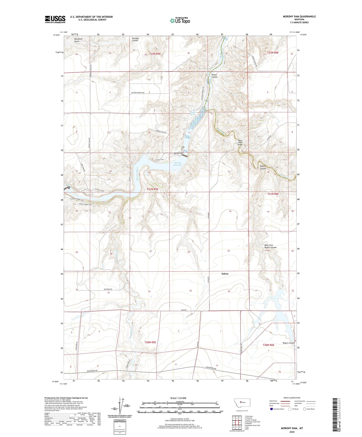
2024 topographic map quadrangle Morony Dam in the state of Montana. Scale: 1:24000. Based on the newly updated USGS 7.5' US Topo map series, this map is in the following counties: Cascade, Chouteau. The map contains contour data, water features, and other items you are used to seeing on USGS maps, but also has updated roads and other features. This is the next generation of topographic maps. Printed on high-quality waterproof paper with UV fade-resistant inks.
Quads adjacent to this one:
West: Northeast Great Falls
Northwest: Flick Lake
North: Floweree
Northeast: Lander Crossing
East: Waltham
Southeast: Belt
South: Fife
Southwest: Southeast Great Falls
This map covers the same area as the classic USGS quad with code o47111e1.
Contains the following named places: 20N05E10BADC01 Well, Belt Creek, Big Falls, Blackfeet Gulch, Box Elder Creek, Hower Coulee, Morony Dam, Morony Reservoir, O'Day Number 1 Dam, O'Day Number 2 Dam, Prairie Nest Ranch 1 Dam, Prairie Nest Ranch 2 Dam, Prairie Nest Ranch 3 Dam, Prairie Nest Ranch 4 Dam, Rogers Coulee, Ryan Dam, Salem, Salem Post Office, Salem Road Bridge, Salem School, Sulphur Spring, The Big Eddy, West Fork Rogers Coulee