MyTopo
Waltham Montana US Topo Map
Couldn't load pickup availability
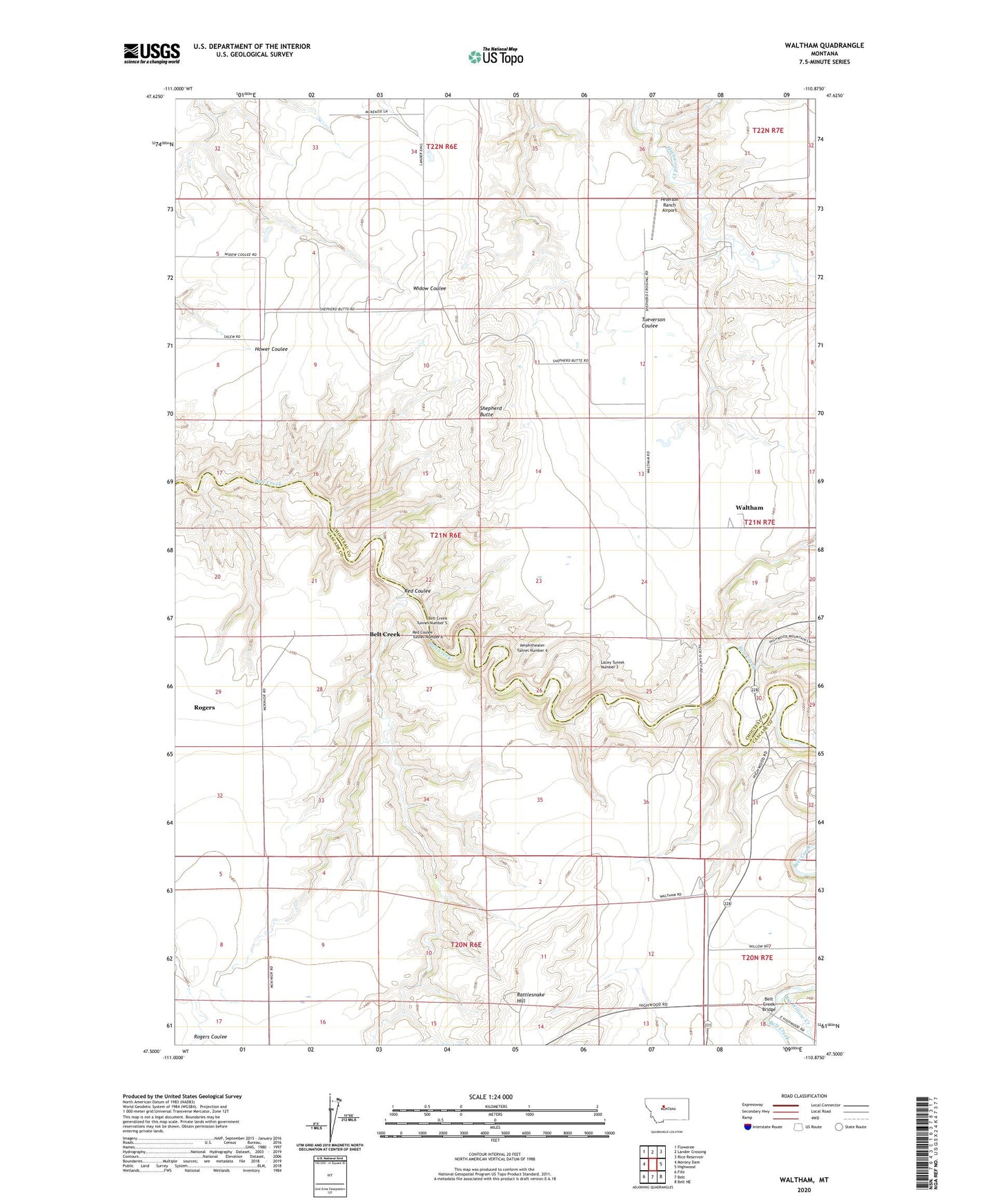
2024 topographic map quadrangle Waltham in the state of Montana. Scale: 1:24000. Based on the newly updated USGS 7.5' US Topo map series, this map is in the following counties: Chouteau, Cascade. The map contains contour data, water features, and other items you are used to seeing on USGS maps, but also has updated roads and other features. This is the next generation of topographic maps. Printed on high-quality waterproof paper with UV fade-resistant inks.
Quads adjacent to this one:
West: Morony Dam
Northwest: Floweree
North: Lander Crossing
Northeast: Rice Reservoir
East: Highwood
Southeast: Belt NE
South: Belt
Southwest: Fife
This map covers the same area as the classic USGS quad with code o47110e8.
Contains the following named places: 21N06E10ABCC01 Well, 21N06E24BAAA01 Well, Amphitheater Tunnel Number 4, Belt Creek, Belt Creek Bridge, Belt Creek Tunnel Number 5, Big Willow Creek, Bowman School, Clingan, Four Corners, Four Corners School, Lacey Tunnel Number 3, Pack and Lacey Crossing, Peterson Ranch Airport, Rattlesnake Hill, Red Coulee, Red Coulee School, Red Coulee Tunnel Number 6, Rogers, Shepherd Butte, Shepherd Butte School, Shepherd Crossing, Waltham, Waltham Post Office, Waltham School, Wetzel School