MyTopo
Four Buttes Montana US Topo Map
Couldn't load pickup availability
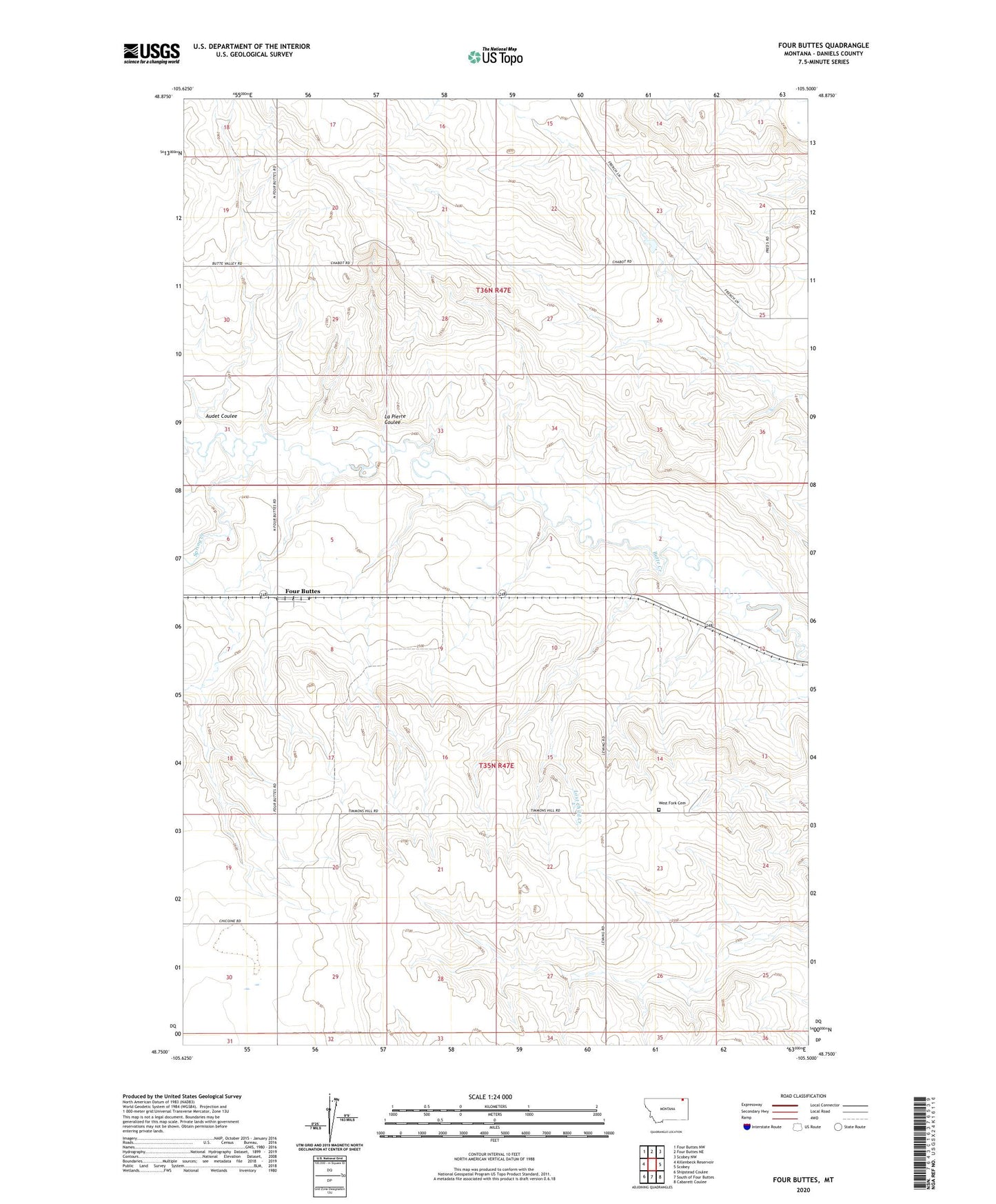
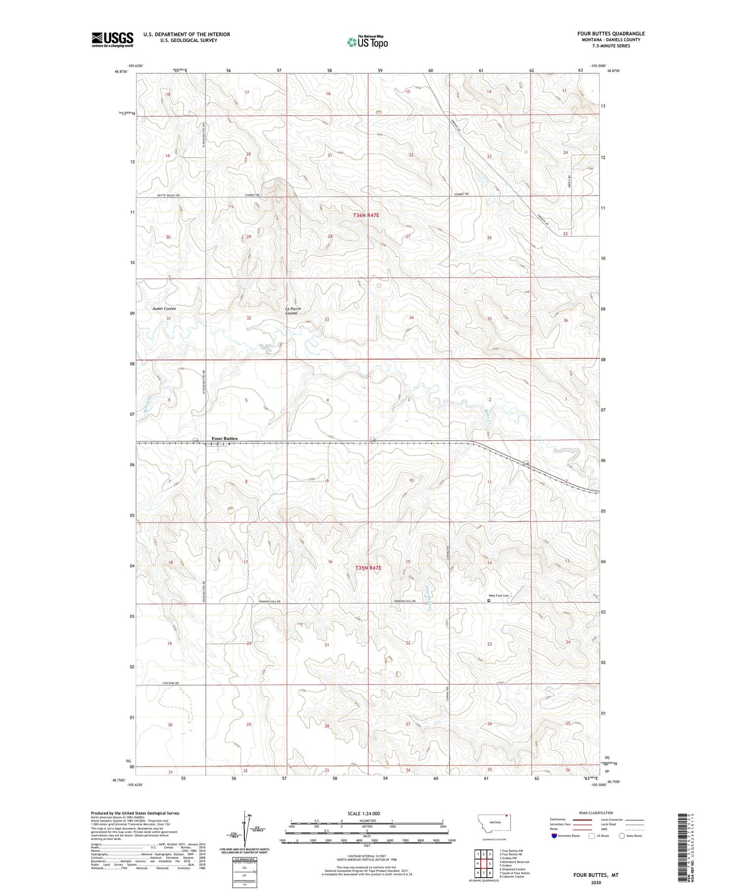
2020 topographic map quadrangle Four Buttes in the state of Montana. Scale: 1:24000. Based on the newly updated USGS 7.5' US Topo map series, this map is in the following counties: Daniels. The map contains contour data, water features, and other items you are used to seeing on USGS maps, but also has updated roads and other features. This is the next generation of topographic maps. Printed on high-quality waterproof paper with UV fade-resistant inks.
Quads adjacent to this one:
West: Killenbeck Reservoir
Northwest: Four Buttes NW
North: Four Buttes NE
Northeast: Scobey NW
East: Scobey
Southeast: Cabarett Coulee
South: South of Four Buttes
Southwest: Shipstead Coulee
Contains the following named places: 35N47E02CDDD01 Well, 35N47E03BBCC01 Well, 35N47E05CCCD01 Well, 35N47E05DCDD01 Well, 35N47E05DDCC01 Well, 35N47E06DDAC01 Well, 35N47E06DDDA01 Well, 35N47E08AABC01 Well, 35N47E08BBAA01 Well, 35N47E08BBAB01 Well, 35N47E08BBBC01 Well, 35N47E10BBCB01 Well, 35N47E12CD__01 Well, 35N47E13BDCC01 Well, 35N47E14BBBB01 Well, 35N47E17CCDA01 Well, 35N47E17CCDD01 Well, 35N47E20ACBD01 Well, 35N47E20ACBD02 Well, 35N47E21BADD01 Well, 35N47E26BCCC01 Well, 35N47E26BCCD01 Well, 35N47E26CBAB01 Well, 35N47E26CBAB02 Well, 35N47E27BBDD01 Well, 35N47E27CABD01 Well, 35N47E30ADCB01 Well, 35N47E30BABD01 Well, 36N47E16DABB01 Well, 36N47E19ACDB01 Well, 36N47E19ACDD01 Well, 36N47E20CCCC01 Well, 36N47E21BDAC01 Well, 36N47E30ABDC01 Well, 36N47E30DCCB01 Well, 59263, Audet Coulee, Chabot Reservoir Dam, Daniels County, Four Buttes, Four Buttes Farmers Elevator, Four Buttes Post Office, Four Buttes School, La Pierre Coulee, Scobey Division, Spring Creek, West Fork Cemetery