MyTopo
South of Four Buttes Montana US Topo Map
Couldn't load pickup availability
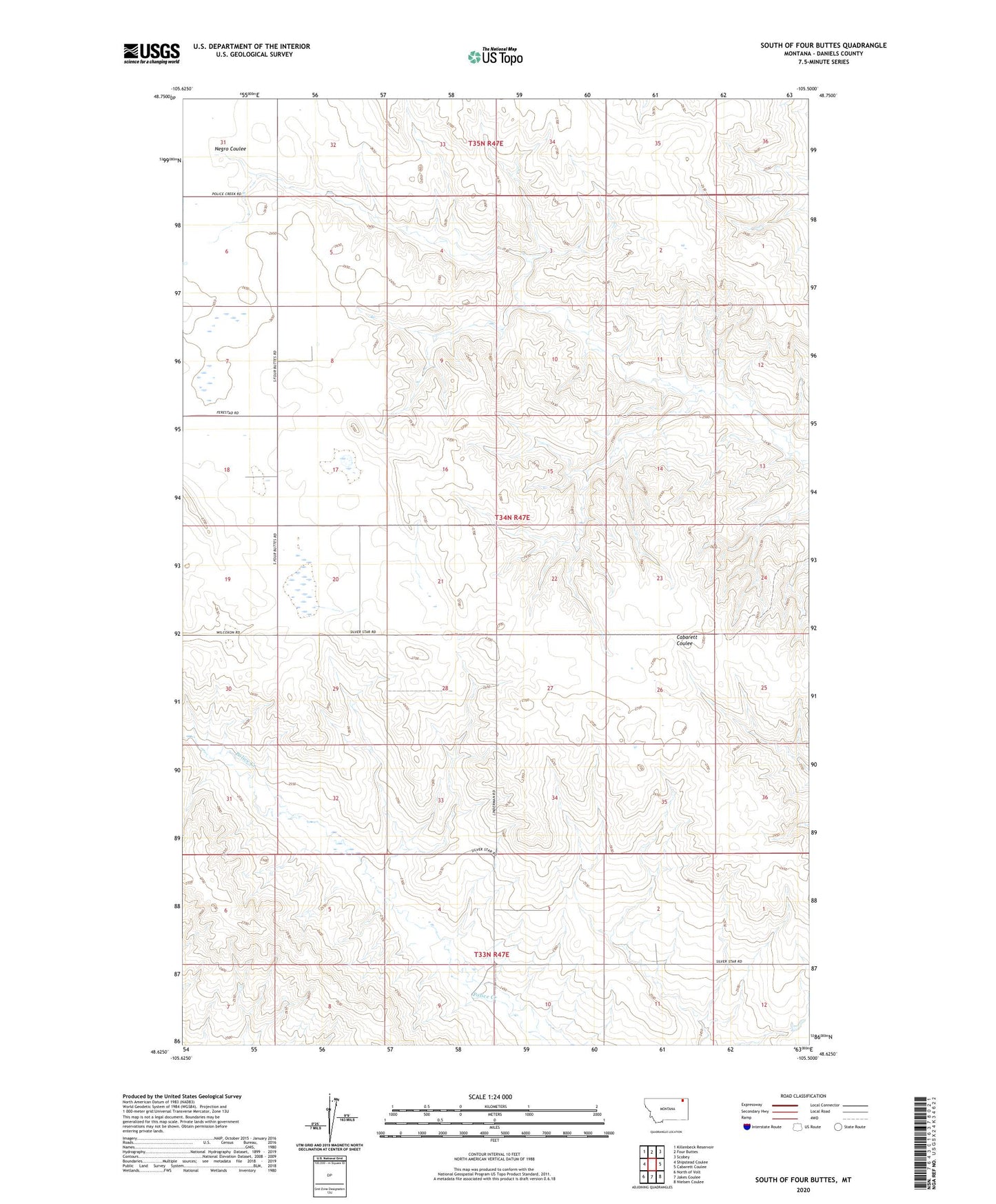
2024 topographic map quadrangle South of Four Buttes in the state of Montana. Scale: 1:24000. Based on the newly updated USGS 7.5' US Topo map series, this map is in the following counties: Daniels. The map contains contour data, water features, and other items you are used to seeing on USGS maps, but also has updated roads and other features. This is the next generation of topographic maps. Printed on high-quality waterproof paper with UV fade-resistant inks.
Quads adjacent to this one:
West: Shipstead Coulee
Northwest: Killenbeck Reservoir
North: Four Buttes
Northeast: Scobey
East: Cabarett Coulee
Southeast: Nielsen Coulee
South: Jakes Coulee
Southwest: North of Volt
This map covers the same area as the classic USGS quad with code o48105f5.
Contains the following named places: 33N47E01DBAC01 Well, 33N47E03BCDD01 Well, 33N47E03BCDD02 Well, 33N47E04CBBB01 Well, 33N47E09AAAA01 Well, 33N47E09AADA01 Well, 34N47E04DCBD01 Well, 34N47E08BDBD01 Well, 34N47E09ADCD01 Well, 34N47E17DCAA01 Well, 34N47E18DBAD01 Well, 34N47E19DAAB01 Well, 34N47E20BAAB01 Well, 34N47E20BAAC01 Well, 34N47E20BBBD01 Well, 34N47E26CDAC01 Well, 34N47E27CCAD01 Well, 34N47E36ABAC01 Well, 34N48E04BCAB01 Well