
MyTopo
Fox Lake Montana US Topo Map
Couldn't load pickup availability
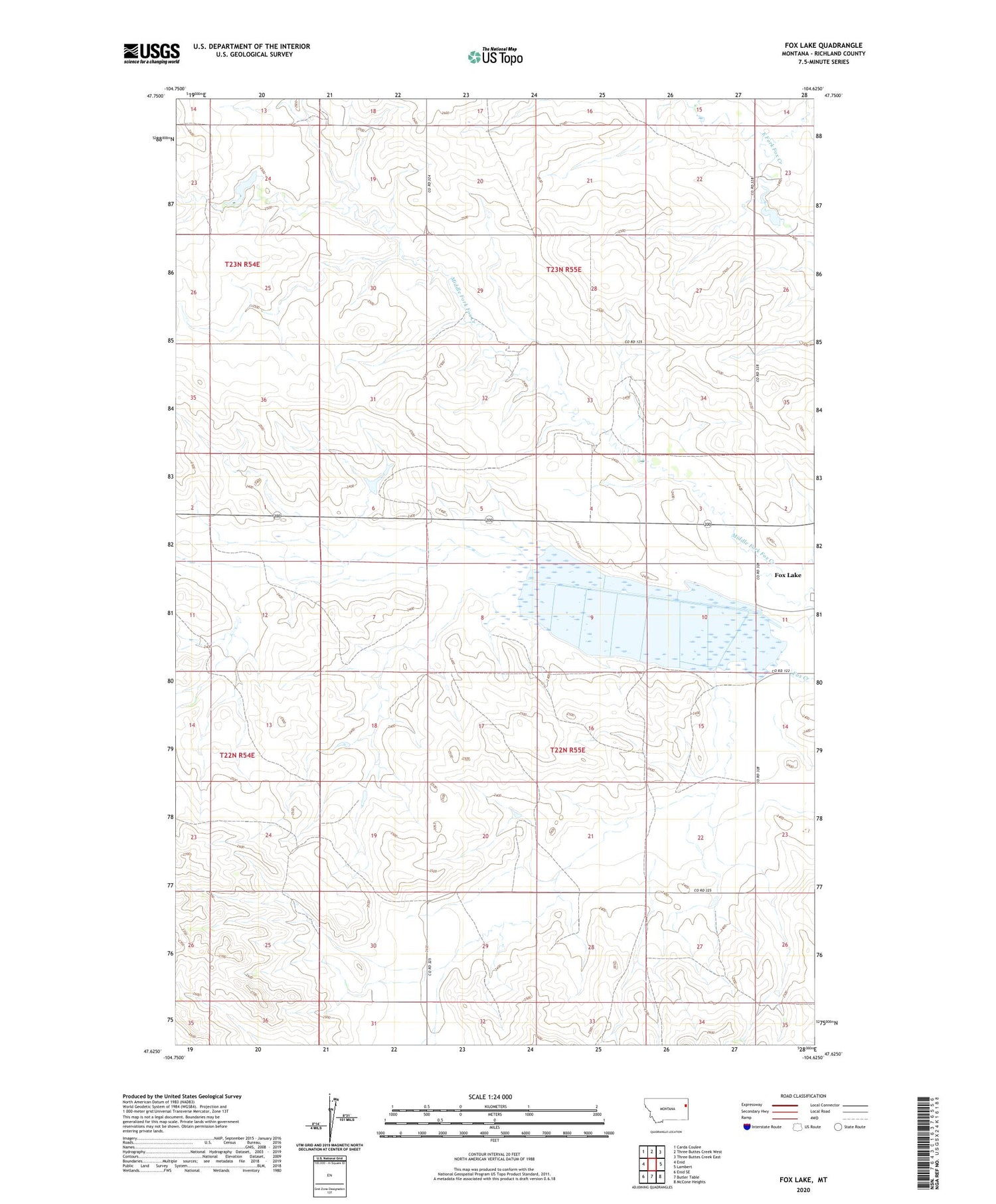
2020 topographic map quadrangle Fox Lake in the state of Montana. Scale: 1:24000. Based on the newly updated USGS 7.5' US Topo map series, this map is in the following counties: Richland. The map contains contour data, water features, and other items you are used to seeing on USGS maps, but also has updated roads and other features. This is the next generation of topographic maps. Printed on high-quality waterproof paper with UV fade-resistant inks.
Quads adjacent to this one:
West: Enid
Northwest: Carda Coulee
North: Three Buttes Creek West
Northeast: Three Buttes Creek East
East: Lambert
Southeast: McCone Heights
South: Butler Table
Southwest: Enid SE
Contains the following named places: 22N55E07ABCD01 Well, 22N55E32ABDB01 Well, 22N58E09BABB01 Well, 22N59E15DCBC01 Well, 23N54E20BCDD01 Well, 23N55E33AACD01 Well, Burke Dam, Fox Lake, Fox Lake Census Designated Place, Fox Lake Wildlife Management Area, Middle Fork Fox Creek, Tri-W-Inc Number 2 Dam


