MyTopo
Butler Table Montana US Topo Map
Couldn't load pickup availability
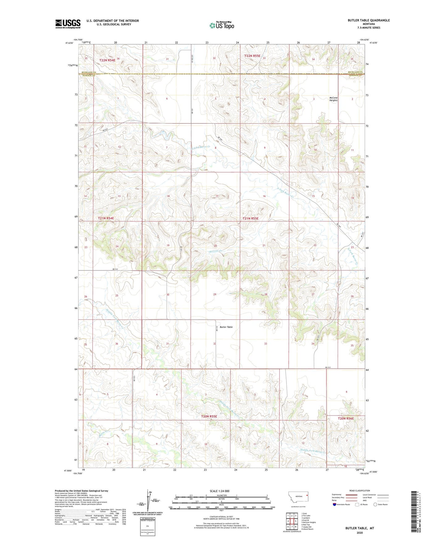
2024 topographic map quadrangle Butler Table in the state of Montana. Scale: 1:24000. Based on the newly updated USGS 7.5' US Topo map series, this map is in the following counties: Dawson, Richland. The map contains contour data, water features, and other items you are used to seeing on USGS maps, but also has updated roads and other features. This is the next generation of topographic maps. Printed on high-quality waterproof paper with UV fade-resistant inks.
Quads adjacent to this one:
West: Enid SE
Northwest: Enid
North: Fox Lake
Northeast: Lambert
East: McCone Heights
Southeast: Allard Ranch
South: Intake NW
Southwest: Red Top
This map covers the same area as the classic USGS quad with code o47104e6.
Contains the following named places: 21N54E12ACCC01 Well, 21N55E03BABC01 Well, 21N55E06BAAA01 Well, 21N55E32ACDD01 Well, 22N55E31DBDD01 Well, Butler School, Butler Table, Butler Table School, Huffman Number 1 Dam, McCone Creek, McCone Post Office, Round Butte School