MyTopo
Lambert Montana US Topo Map
Couldn't load pickup availability
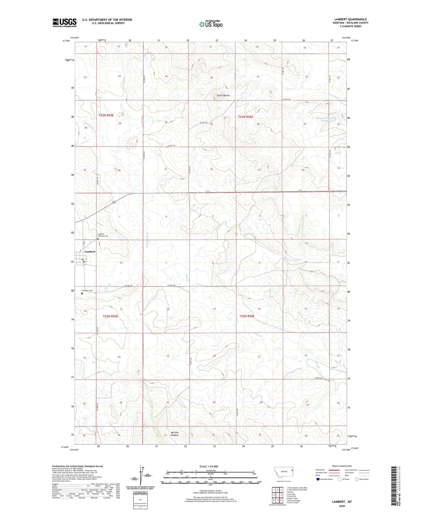
2024 topographic map quadrangle Lambert in the state of Montana. Scale: 1:24000. Based on the newly updated USGS 7.5' US Topo map series, this map is in the following counties: Richland. The map contains contour data, water features, and other items you are used to seeing on USGS maps, but also has updated roads and other features. This is the next generation of topographic maps. Printed on high-quality waterproof paper with UV fade-resistant inks.
Quads adjacent to this one:
West: Fox Lake
Northwest: Three Buttes Creek West
North: Three Buttes Creek East
Northeast: Girard
East: Crane NW
Southeast: Larson School
South: McCone Heights
Southwest: Butler Table
This map covers the same area as the classic USGS quad with code o47104f5.
Contains the following named places: 21N57E10CDDD01 Well, 22N55E01AACA01 Well, 22N55E23ADBD01 Well, 22N55E26AD__01 Well, 22N56E05BCAC01 Well, 22N56E15BDCC01 Well, 22N56E22CADA01 Well, 23N55E25DCCC01 Well, 23N56E32BBBC01 Well, A M Prevost Dam, Christian and Missionary Alliance Church, East Fork Fox Creek, First Lutheran Church, Fox Lake, Historical Society Museum, Lambert, Lambert Catholic Cemetery, Lambert Cemetery, Lambert Park, Lambert Post Office, Lambert Rural Fire District, Lambert School, Nortana Grain Company Elevator, Occident Elevator Company Elevator, Prevost Number 2 Dam, Prevost Reservoir Number 2, Richland County Ambulance Lambert, Saint Theresas Catholic Church, Three Buttes, Three Buttes Creek, Union Congregational Church