MyTopo
Gallatin Peak Montana US Topo Map
Couldn't load pickup availability
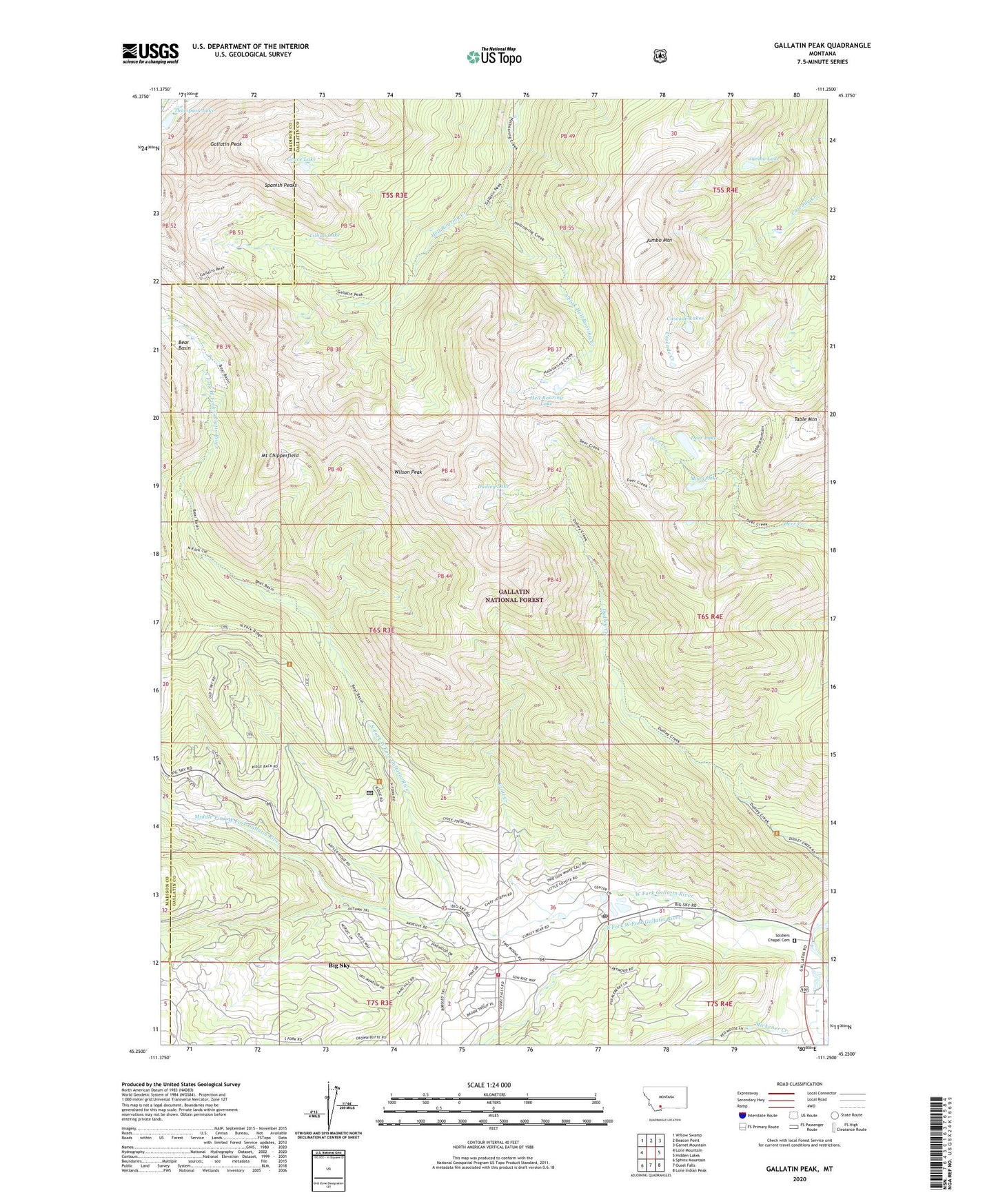
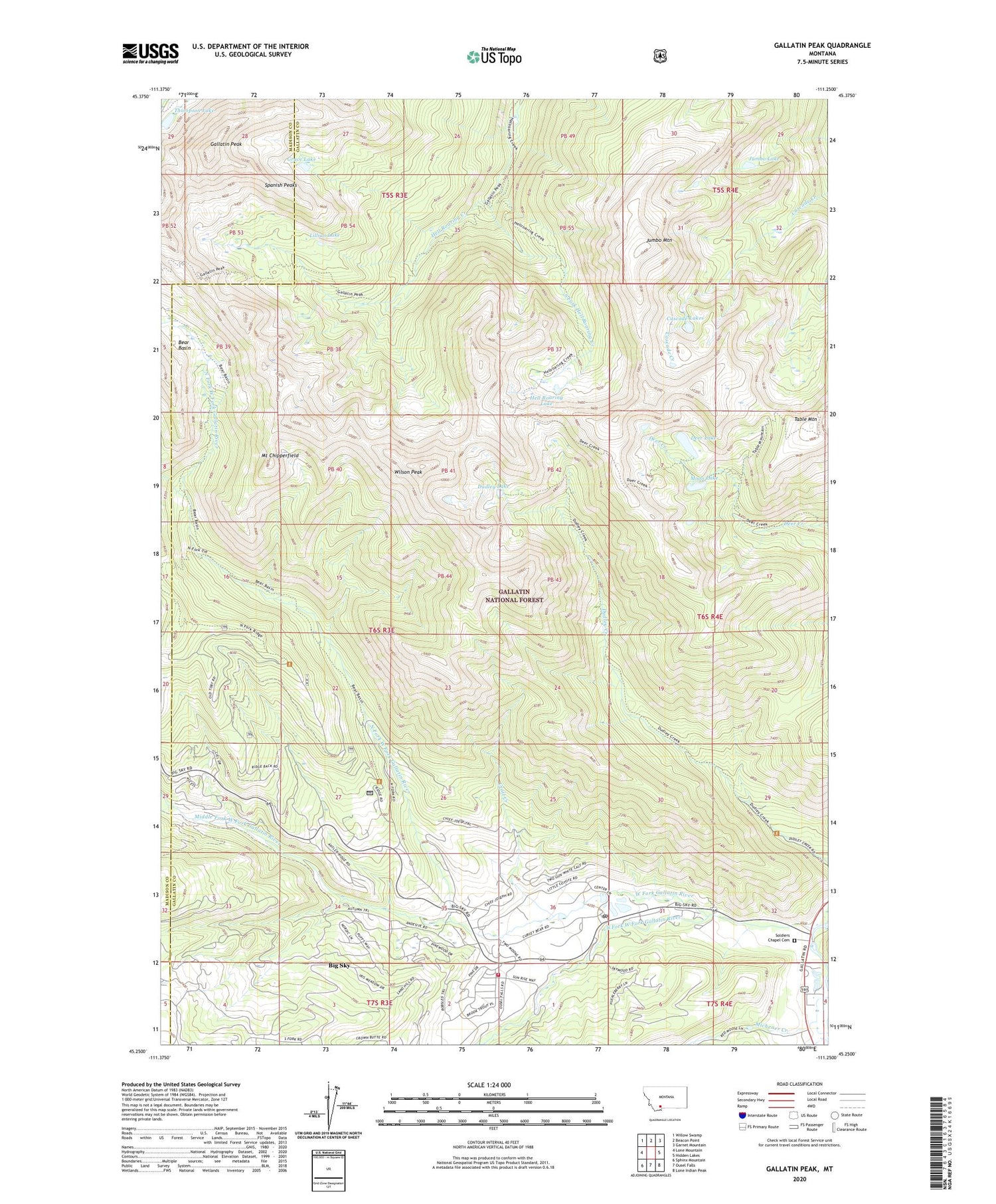
2020 topographic map quadrangle Gallatin Peak in the state of Montana. Scale: 1:24000. Based on the newly updated USGS 7.5' US Topo map series, this map is in the following counties: Gallatin, Madison. The map contains contour data, water features, and other items you are used to seeing on USGS maps, but also has updated roads and other features. This is the next generation of topographic maps. Printed on high-quality waterproof paper with UV fade-resistant inks.
Quads adjacent to this one:
West: Lone Mountain
Northwest: Willow Swamp
North: Beacon Point
Northeast: Garnet Mountain
East: Hidden Lakes
Southeast: Lone Indian Peak
South: Ousel Falls
Southwest: Sphinx Mountain
Contains the following named places: B K Ranch, Bear Basin, Big Sky, Big Sky Canyon Village, Big Sky Census Designated Place, Big Sky Fire Station 1, Big Sky Golf Course, Big Sky Meadow Village, Big Sky Mobile Home Court, Big Sky Post Office, Cascade Lakes, Crail Creek, Crail Ranch, Deer Lake, Dudley Lake, Gallatin Peak, George Norman Trailer Court, Grace Lake, Hell Roaring Lake, Jumbo Lake, Jumbo Mountain, Lee Metcalf Wilderness (Spanish Peaks Unit), Lillian Lake, Michener Creek, Middle Fork West Fork Gallatin River, Moon Lake, Mount Chipperfield, North Fork West Fork Gallatin River, Soldiers Chapel, Soldiers Chapel Cemetery, South Fork Hell Roaring Creek, South Fork West Fork Gallatin River, Spanish Peaks, Table Mountain, Table Mountain Mine, Thompson Lake, West Fork Gallatin River, Wilson Peak