MyTopo
Hidden Lakes Montana US Topo Map
Couldn't load pickup availability
Also explore the Hidden Lakes Forest Service Topo of this same quad for updated USFS data
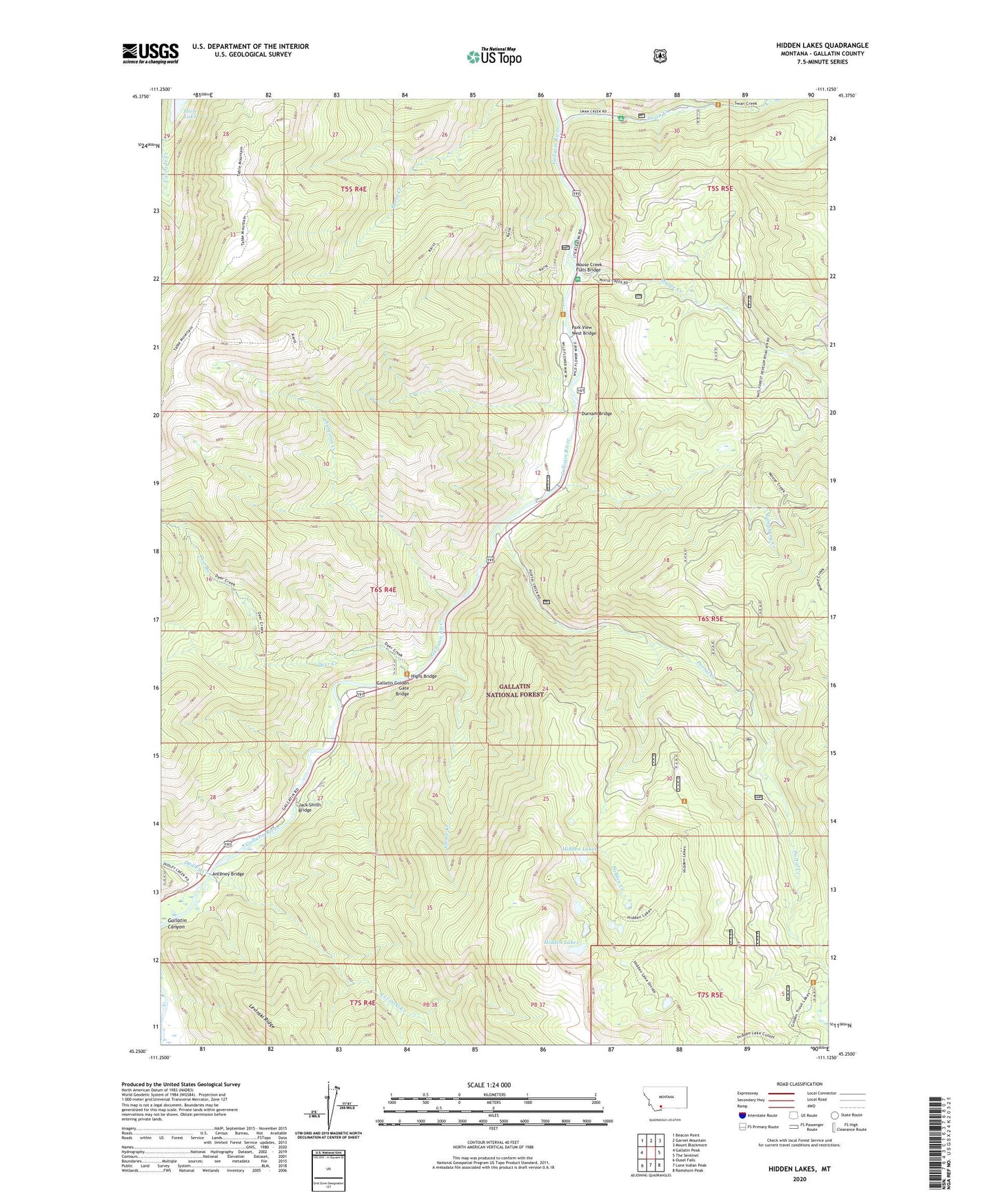
2024 topographic map quadrangle Hidden Lakes in the state of Montana. Scale: 1:24000. Based on the newly updated USGS 7.5' US Topo map series, this map is in the following counties: Gallatin. The map contains contour data, water features, and other items you are used to seeing on USGS maps, but also has updated roads and other features. This is the next generation of topographic maps. Printed on high-quality waterproof paper with UV fade-resistant inks.
Quads adjacent to this one:
West: Gallatin Peak
Northwest: Beacon Point
North: Garnet Mountain
Northeast: Mount Blackmore
East: The Sentinel
Southeast: Ramshorn Peak
South: Lone Indian Peak
Southwest: Ousel Falls
Contains the following named places: Anceney Bridge, Asbestos Creek, Big Sky Division, Deer Creek, Dudley Creek, Dudley Creek Mine, Durnam Bridge, Gallatin Golden Gate Bridge, Goose Creek, Hidden Creek, Hidden Lakes, Highs Bridge, Jack Smith Bridge, Karst Asbestos Mine, Karst Power Plant, Karst Ranch, Levinski Creek, Moose Creek, Moose Creek Flat Recreation Site, Moose Creek Flats Bridge, Moose Flat Campground, Park View West Bridge, Portal Creek, Rocking Horse Bridge, Sage Brush Point Bridge, Shady Rest Camp, Swan Creek, Swan Creek Campground, Tamphery Creek