MyTopo
Ousel Falls Montana US Topo Map
Couldn't load pickup availability
Also explore the Ousel Falls Forest Service Topo of this same quad for updated USFS data
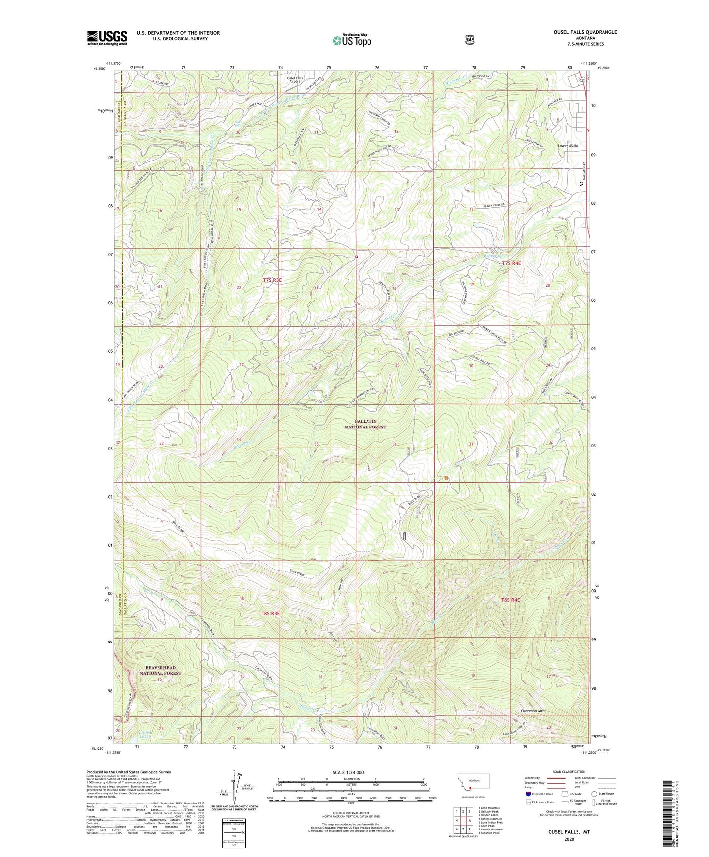
2024 topographic map quadrangle Ousel Falls in the state of Montana. Scale: 1:24000. Based on the newly updated USGS 7.5' US Topo map series, this map is in the following counties: Gallatin, Madison. The map contains contour data, water features, and other items you are used to seeing on USGS maps, but also has updated roads and other features. This is the next generation of topographic maps. Printed on high-quality waterproof paper with UV fade-resistant inks.
Quads adjacent to this one:
West: Sphinx Mountain
Northwest: Lone Mountain
North: Gallatin Peak
Northeast: Hidden Lakes
East: Lone Indian Peak
Southeast: Sunshine Point
South: Lincoln Mountain
Southwest: Koch Peak
This map covers the same area as the classic USGS quad with code o45111b3.
Contains the following named places: Cinnamon Mountain, Doe Creek, First Yellow Mule Creek, Lazy T 4 Ranch, Lizard Lakes, Michel Ranch, Ophir School, Ousel Falls, Ousel Falls Airport, Ousel Falls Recreation Site, Smith Ranch, Yellowstone Mountain Club Fire Department