MyTopo
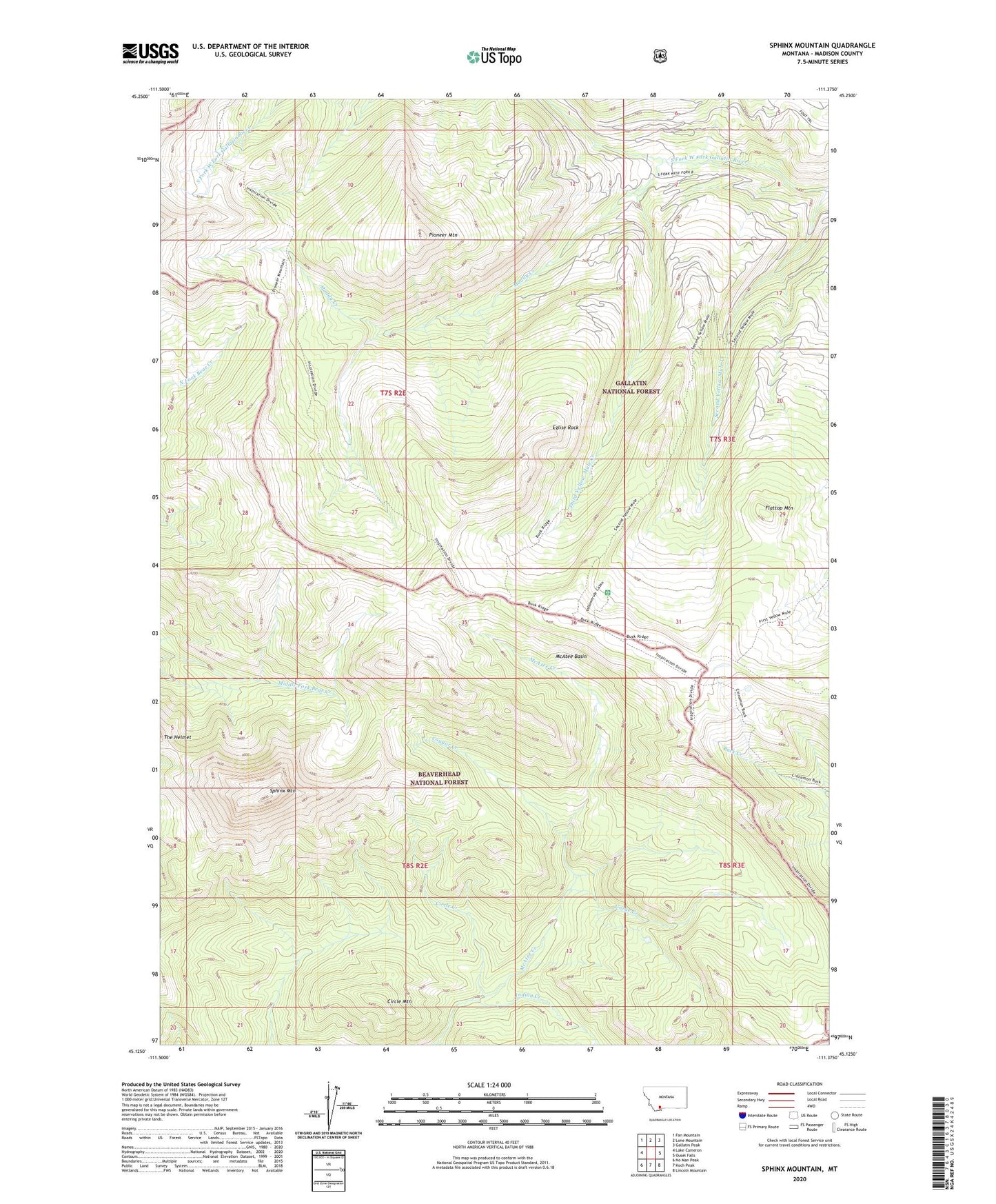
Sphinx Mountain Montana US Topo Map
Couldn't load pickup availability
Also explore the Sphinx Mountain Forest Service Topo of this same quad for updated USFS data
2024 topographic map quadrangle Sphinx Mountain in the state of Montana. Scale: 1:24000. Based on the newly updated USGS 7.5' US Topo map series, this map is in the following counties: Madison. The map contains contour data, water features, and other items you are used to seeing on USGS maps, but also has updated roads and other features. This is the next generation of topographic maps. Printed on high-quality waterproof paper with UV fade-resistant inks.
Quads adjacent to this one:
West: Lake Cameron
Northwest: Fan Mountain
North: Lone Mountain
Northeast: Gallatin Peak
East: Ousel Falls
Southeast: Lincoln Mountain
South: Koch Peak
Southwest: No Man Peak
This map covers the same area as the classic USGS quad with code o45111b4.
Contains the following named places: Big Spring Ranger Station, Circle Creek, Circle Mountain, Cougar Creek, Eglise Rock, Flattop Mountain, Gorge Creek, Indian Crossing, Lee Metcalf Wilderness, Manley Camp, McAtee Basin, McAtee Creek, Muddy Creek, Pioneer Mountain, Second Yellow Mule Creek, Sphinx Mountain, Third Yellow Mule Creek, Yellow Mule Ranger Station