MyTopo
Gallatin Rapids Montana US Topo Map
Couldn't load pickup availability
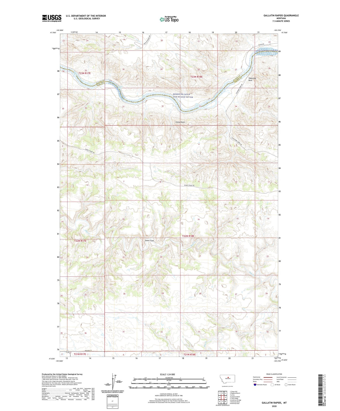
2024 topographic map quadrangle Gallatin Rapids in the state of Montana. Scale: 1:24000. Based on the newly updated USGS 7.5' US Topo map series, this map is in the following counties: Fergus, Blaine. The map contains contour data, water features, and other items you are used to seeing on USGS maps, but also has updated roads and other features. This is the next generation of topographic maps. Printed on high-quality waterproof paper with UV fade-resistant inks.
Quads adjacent to this one:
West: Council Island
Northwest: Chase Hill
North: Ragland Bench
Northeast: Leroy
East: Taffy Ridge
Southeast: Winifred East
South: Winifred West
Southwest: Anderson Bridge
This map covers the same area as the classic USGS quad with code o47109f4.
Contains the following named places: 22N17E35DDDD01 Well, Bear Rapids, Dauphin Rapids, Flax Coulee, Gallatin Rapids, Jones Cone, Leslie Point, Little Dog Rapids, Oil Well Hill, Robinson School, Sugarloaf Rock, Whiskey Ridge