MyTopo
Ragland Bench Montana US Topo Map
Couldn't load pickup availability
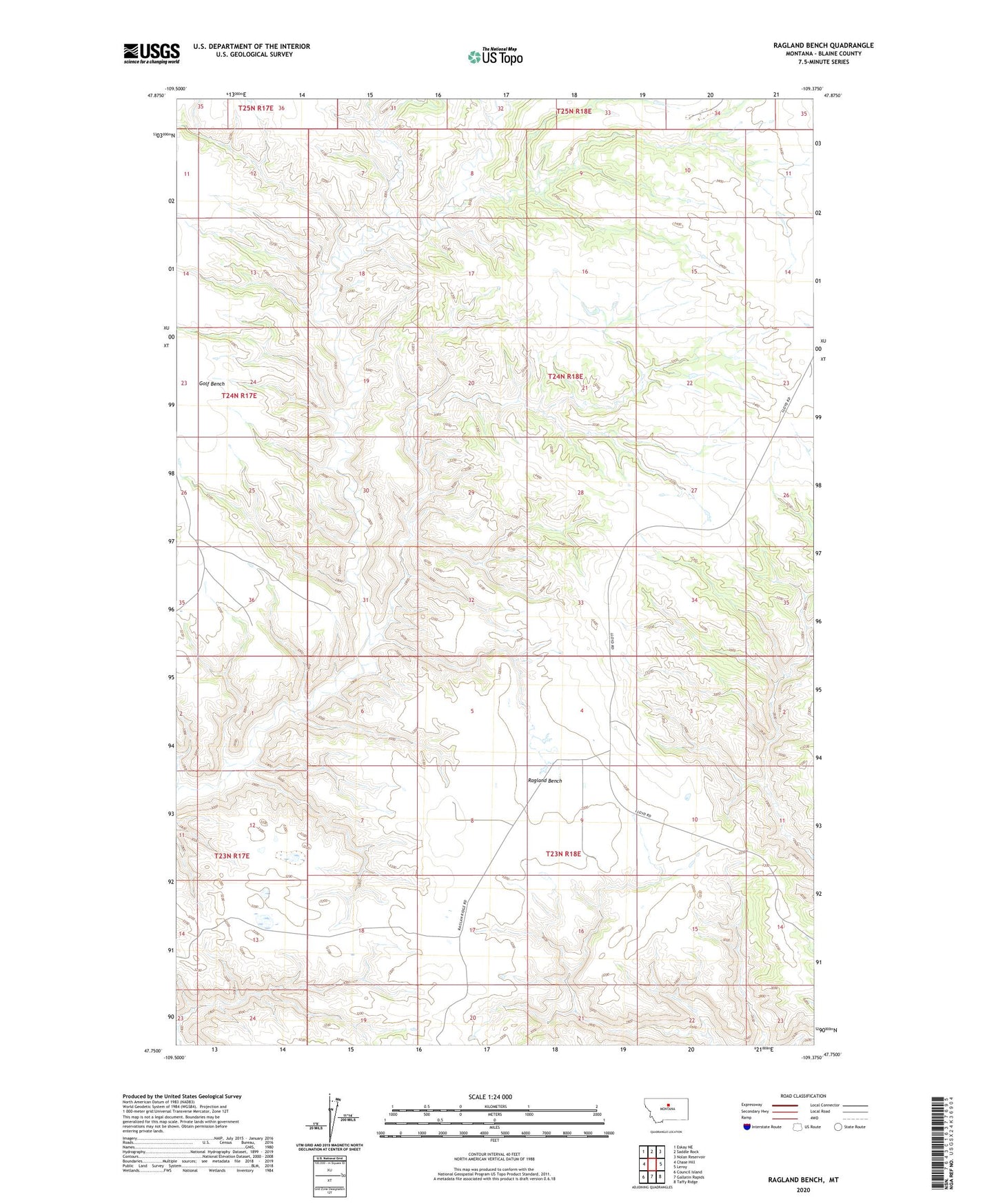
2024 topographic map quadrangle Ragland Bench in the state of Montana. Scale: 1:24000. Based on the newly updated USGS 7.5' US Topo map series, this map is in the following counties: Blaine. The map contains contour data, water features, and other items you are used to seeing on USGS maps, but also has updated roads and other features. This is the next generation of topographic maps. Printed on high-quality waterproof paper with UV fade-resistant inks.
Quads adjacent to this one:
West: Chase Hill
Northwest: Eskay NE
North: Saddle Rock
Northeast: Nolan Reservoir
East: Leroy
Southeast: Taffy Ridge
South: Gallatin Rapids
Southwest: Council Island
This map covers the same area as the classic USGS quad with code o47109g4.
Contains the following named places: Bills Coulee, Golf Bench, Hosey, Hosey Post Office, Kabo Post Office, Ragland Bench, Ragland Bench School