MyTopo
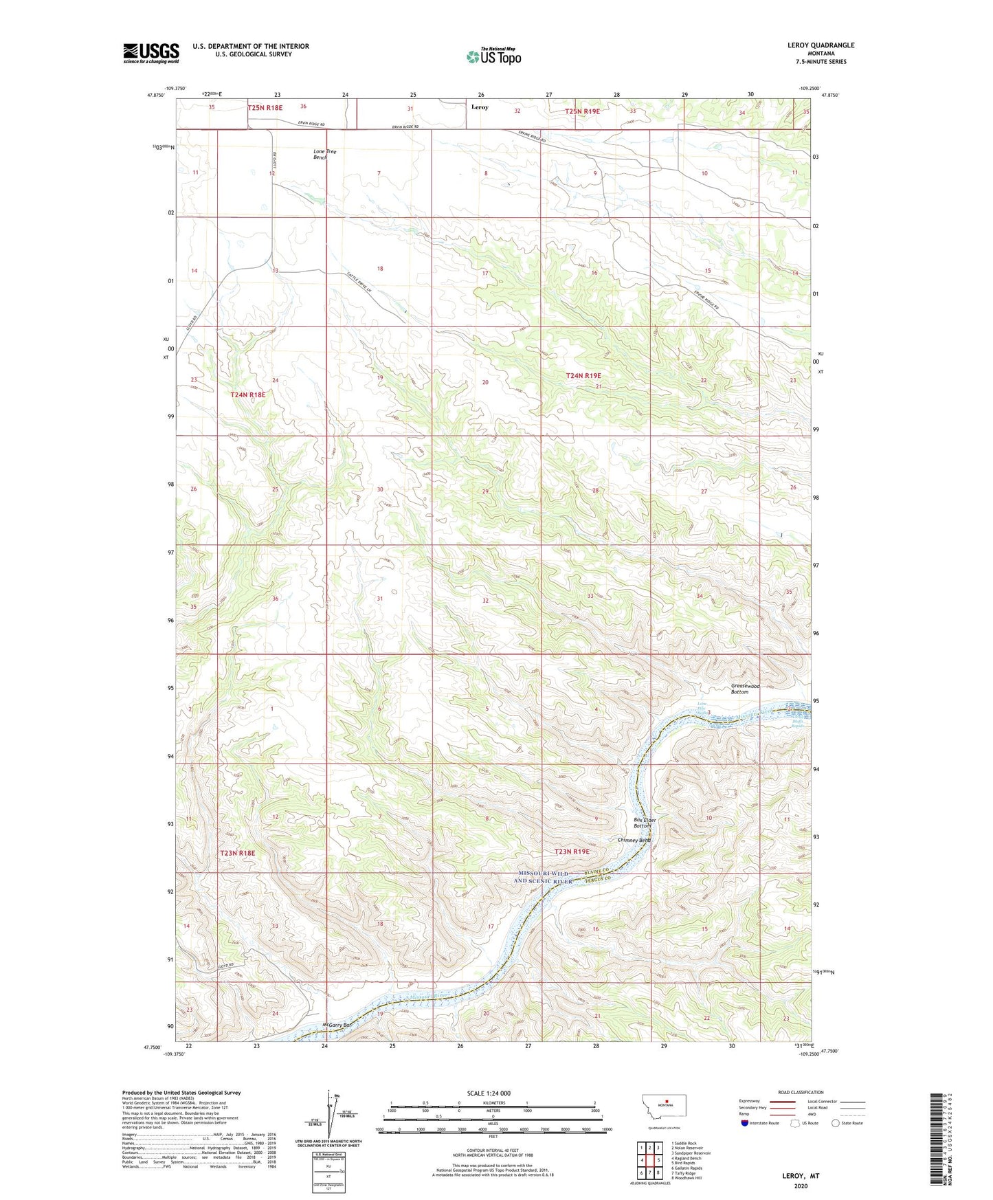
Leroy Montana US Topo Map
Couldn't load pickup availability
2024 topographic map quadrangle Leroy in the state of Montana. Scale: 1:24000. Based on the newly updated USGS 7.5' US Topo map series, this map is in the following counties: Blaine, Fergus. The map contains contour data, water features, and other items you are used to seeing on USGS maps, but also has updated roads and other features. This is the next generation of topographic maps. Printed on high-quality waterproof paper with UV fade-resistant inks.
Quads adjacent to this one:
West: Ragland Bench
Northwest: Saddle Rock
North: Nolan Reservoir
Northeast: Sandpiper Reservoir
East: Bird Rapids
Southeast: Woodhawk Hill
South: Taffy Ridge
Southwest: Gallatin Rapids
This map covers the same area as the classic USGS quad with code o47109g3.
Contains the following named places: Barnard Ridge, Box Elder Bottom, Castle Bluff Rapids, Chimney Bend, Coal Ridge, Greasewood Bottom, Lake Ridge, Leroy, Leroy Post Office, Lone Pine Rapids, Lone Tree Bench, Lone Tree Bench School, Lost Ridge, McGarry Bar, Red Rock Ridge, Upper Missouri River Breaks National Monument