MyTopo
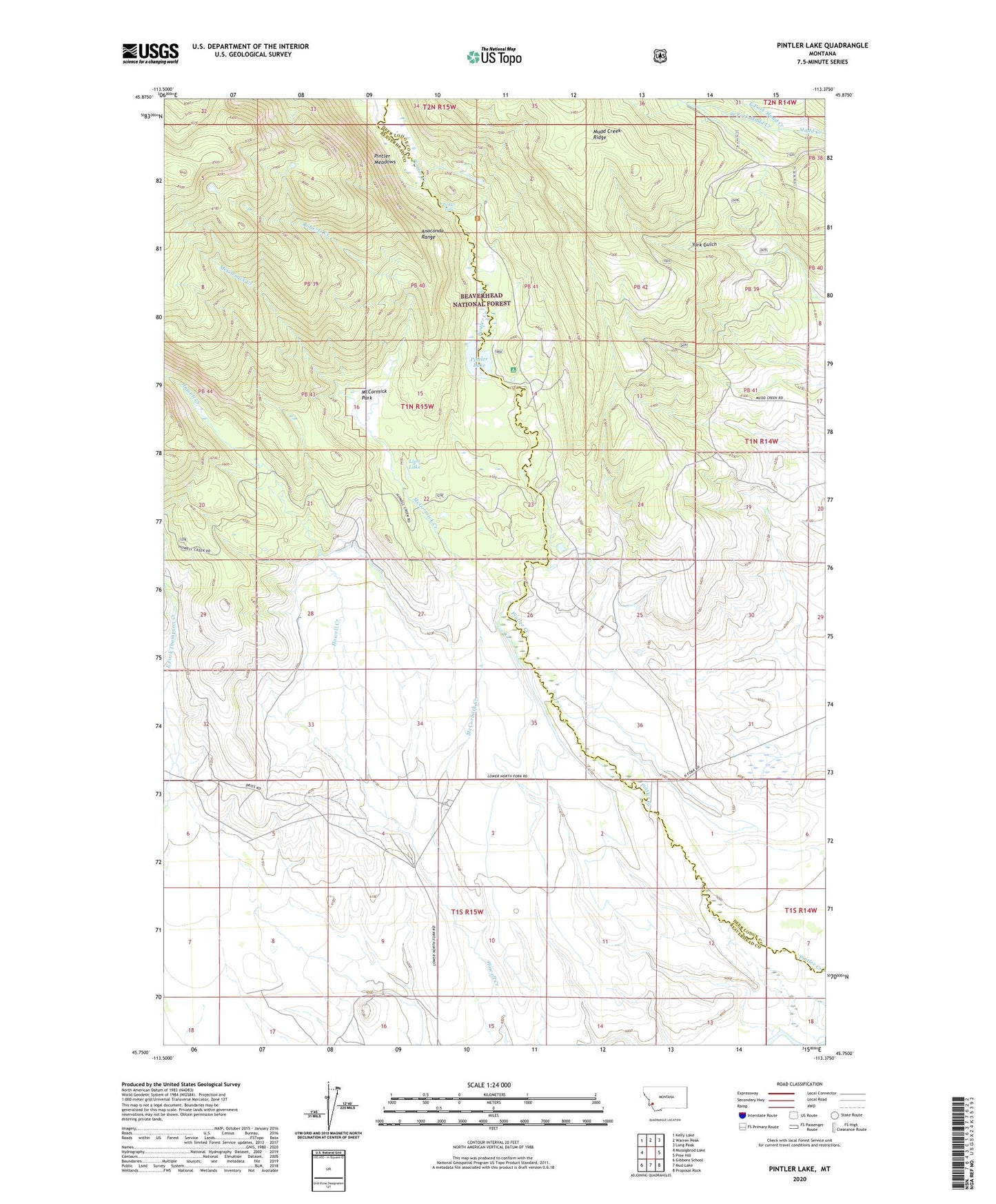
Pintler Lake Montana US Topo Map
Couldn't load pickup availability
Also explore the Pintler Lake Forest Service Topo of this same quad for updated USFS data
2024 topographic map quadrangle Pintler Lake in the state of Montana. Scale: 1:24000. Based on the newly updated USGS 7.5' US Topo map series, this map is in the following counties: Beaverhead, Deer Lodge. The map contains contour data, water features, and other items you are used to seeing on USGS maps, but also has updated roads and other features. This is the next generation of topographic maps. Printed on high-quality waterproof paper with UV fade-resistant inks.
Quads adjacent to this one:
West: Mussigbrod Lake
Northwest: Kelly Lake
North: Warren Peak
Northeast: Long Peak
East: Pine Hill
Southeast: Proposal Rock
South: Mud Lake
Southwest: Gibbons School
This map covers the same area as the classic USGS quad with code o45113g4.
Contains the following named places: 01N15W14BCAA01 Well, 01N15W34DADC01 Well, 01N15W34DDAB01 Well, 01N15W34DDAB02 Well, 01S15W02ADAC01 Well, 01S15W03BBCD01 Well, 01S15W03BCBA01 Well, 01S15W03BCBA02 Well, 01S15W04DACC01 Well, 01S15W08BADD01 Well, Big Bushong Ditch, Bowen Post Office, Bowen School, Christensen Ranch, Christenson Ditch, Dreise Ranch, East Fork Mudd Creek, East Fork Thompson Creek, L Bacon Ranch, Lion Lake, McCormick Creek, McCormick Park, Nyhart Ditch, Pintler Campground, Pintler Falls, Pintler Lake, Pintler Meadows, Roberts Creek, Sparrow Waste Ditch, West Fork Mudd Creek