MyTopo
Seventh Point Buttes Montana US Topo Map
Couldn't load pickup availability
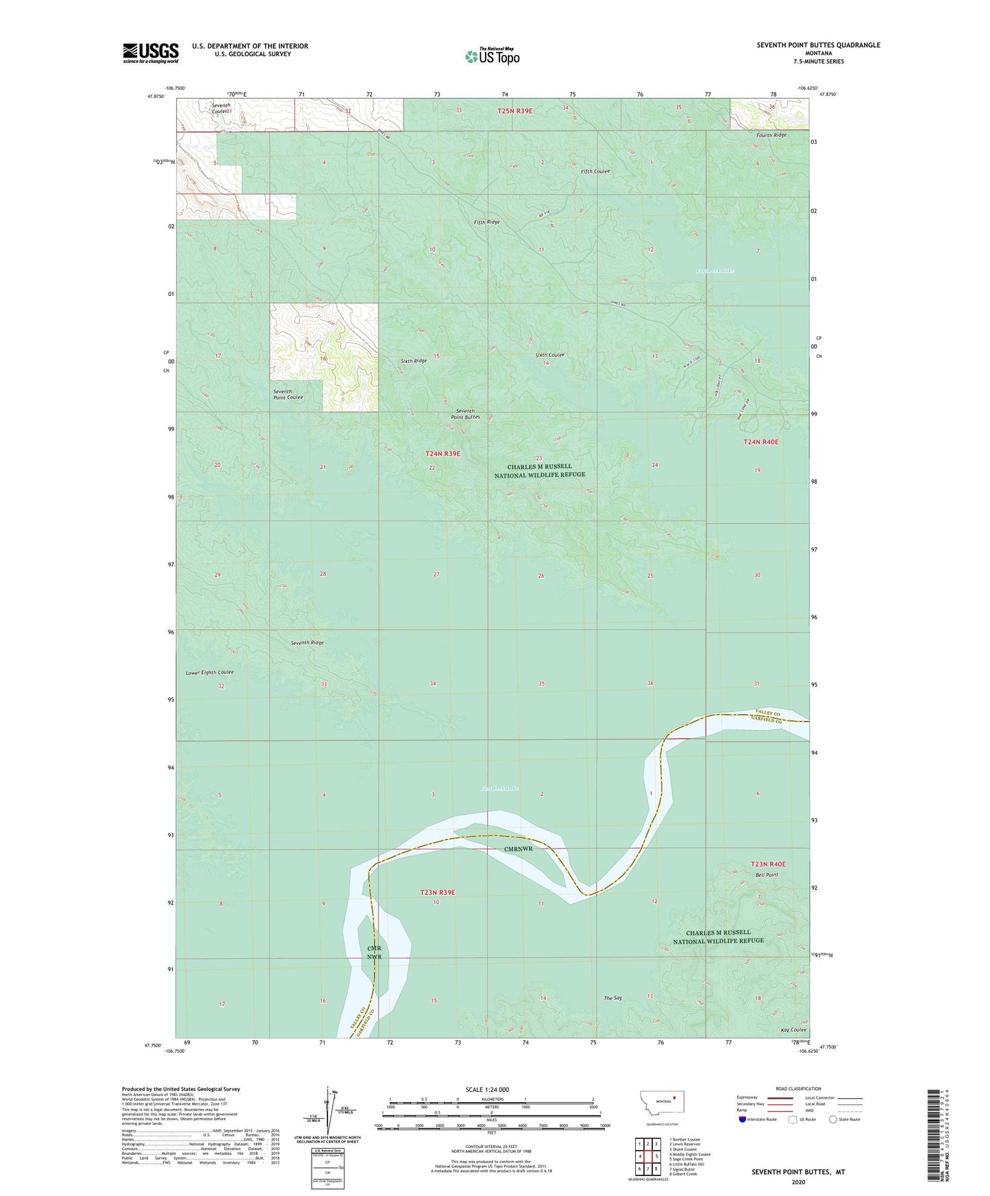
2024 topographic map quadrangle Seventh Point Buttes in the state of Montana. Scale: 1:24000. Based on the newly updated USGS 7.5' US Topo map series, this map is in the following counties: Valley, Garfield. The map contains contour data, water features, and other items you are used to seeing on USGS maps, but also has updated roads and other features. This is the next generation of topographic maps. Printed on high-quality waterproof paper with UV fade-resistant inks.
Quads adjacent to this one:
West: Middle Eighth Coulee
Northwest: Bomber Coulee
North: Lewis Reservoir
Northeast: Skunk Coulee
East: Sage Creek Point
Southeast: Gilbert Creek
South: Signal Butte
Southwest: Little Buffalo Hill
This map covers the same area as the classic USGS quad with code o47106g6.
Contains the following named places: 01S41E05CDAA01 Well, Bell Point, Eight Point Post Office, Eighth Point School, Fifth Coulee, Fifth Ridge, Fourth Ridge, Lower Eighth Coulee, Seventh Coulee, Seventh Point Buttes, Seventh Point Coulee, Sixth Coulee, Sixth Point School, Sixth Ridge, The Pines Recreation Area, The Sag