MyTopo
Signal Butte Montana US Topo Map
Couldn't load pickup availability
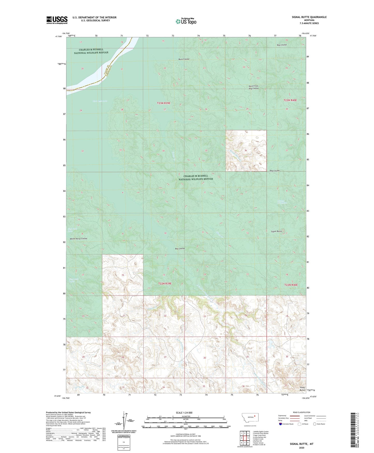
2024 topographic map quadrangle Signal Butte in the state of Montana. Scale: 1:24000. Based on the newly updated USGS 7.5' US Topo map series, this map is in the following counties: Garfield, Valley. The map contains contour data, water features, and other items you are used to seeing on USGS maps, but also has updated roads and other features. This is the next generation of topographic maps. Printed on high-quality waterproof paper with UV fade-resistant inks.
Quads adjacent to this one:
West: Little Buffalo Hill
Northwest: Middle Eighth Coulee
North: Seventh Point Buttes
Northeast: Sage Creek Point
East: Gilbert Creek
Southeast: Gilbert Creek SE
South: Kester School
Southwest: Buffalo Hill
This map covers the same area as the classic USGS quad with code o47106f6.
Contains the following named places: 22N39E23CDA_01 Well, Bog Coulee, Bunn Coulee, Cattle Creek, Cole Ranch, East Fork Cattle Creek, East Fork Crooked Creek, Rough Sheep Creek, Sheep Creek, Signal Butte, Swallow Nest Spring, White Horse Coulee