
MyTopo
Gilman Montana US Topo Map
Couldn't load pickup availability
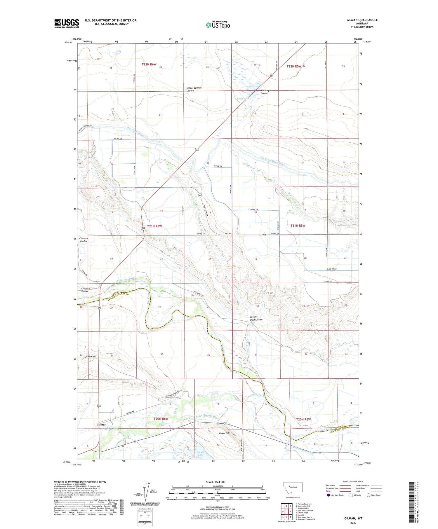
2020 topographic map quadrangle Gilman in the state of Montana. Scale: 1:24000. Based on the newly updated USGS 7.5' US Topo map series, this map is in the following counties: Teton, Lewis and Clark. The map contains contour data, water features, and other items you are used to seeing on USGS maps, but also has updated roads and other features. This is the next generation of topographic maps. Printed on high-quality waterproof paper with UV fade-resistant inks.
Quads adjacent to this one:
West: Split Rock Junction
Northwest: Pishkun Reservoir
North: Nunemaker Hill
Northeast: Sevenmile Hill
East: Golden Ridge
Southeast: Bowmans Corners NW
South: Gouchnour Ranch
Southwest: Augusta
Contains the following named places: 20N05W07A___01 Well, 20N06W01A___01 Well, Basin Lake, Bickel, Clemons Coulee, Cutting Shed Coulee, Elk Creek, Florence Post Office, Florence Springs Post Office, Gilman, Gilman Census Designated Place, Gilman Hill, Gilman Post Office, Gilman School, Hogan Slough, Liberty School, Maloney Coulee, Meyer Hill, Meyer Lake, Spring Creek, Sun River Historical Marker, Sun River Slope Canal


