MyTopo
Nunemaker Hill Montana US Topo Map
Couldn't load pickup availability
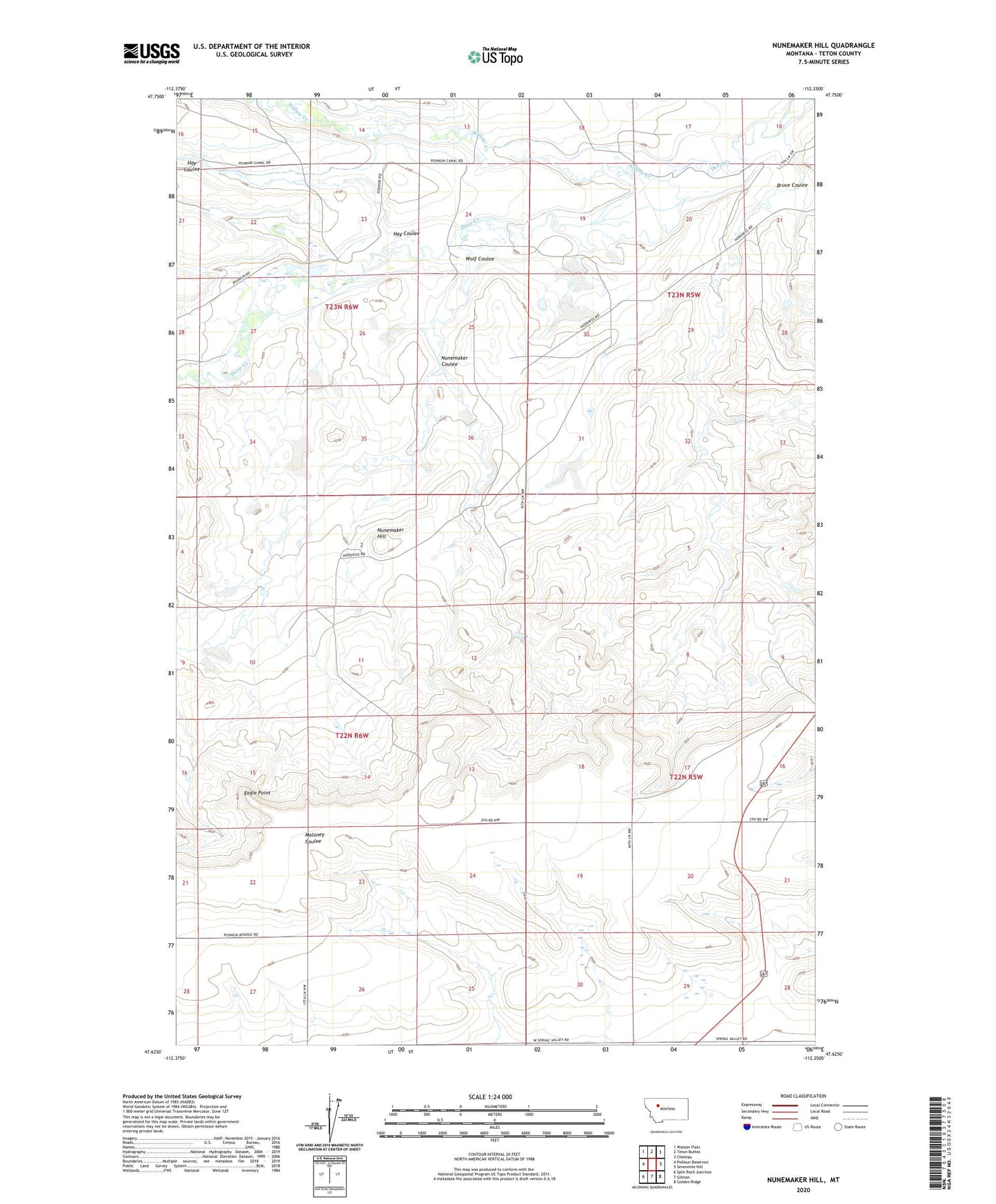
2024 topographic map quadrangle Nunemaker Hill in the state of Montana. Scale: 1:24000. Based on the newly updated USGS 7.5' US Topo map series, this map is in the following counties: Teton. The map contains contour data, water features, and other items you are used to seeing on USGS maps, but also has updated roads and other features. This is the next generation of topographic maps. Printed on high-quality waterproof paper with UV fade-resistant inks.
Quads adjacent to this one:
West: Pishkun Reservoir
Northwest: Watson Flats
North: Teton Buttes
Northeast: Choteau
East: Sevenmile Hill
Southeast: Golden Ridge
South: Gilman
Southwest: Split Rock Junction
This map covers the same area as the classic USGS quad with code o47112f3.
Contains the following named places: Bruce Coulee, Burch Ranch, Eagle Point, Hay Coulee, Hodgskiss Ranch, Jonquil Dam, Nunemaker Coulee, Nunemaker Hill, Willow Creek, Wolf Coulee