MyTopo
Golden Ridge Montana US Topo Map
Couldn't load pickup availability
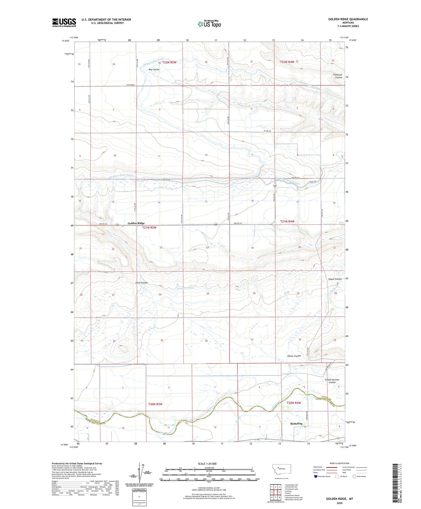
2024 topographic map quadrangle Golden Ridge in the state of Montana. Scale: 1:24000. Based on the newly updated USGS 7.5' US Topo map series, this map is in the following counties: Teton, Lewis and Clark. The map contains contour data, water features, and other items you are used to seeing on USGS maps, but also has updated roads and other features. This is the next generation of topographic maps. Printed on high-quality waterproof paper with UV fade-resistant inks.
Quads adjacent to this one:
West: Gilman
Northwest: Nunemaker Hill
North: Sevenmile Hill
Northeast: Freezeout Lake
East: Lowry
Southeast: Bowmans Corners NE
South: Bowmans Corners NW
Southwest: Gouchnour Ranch
This map covers the same area as the classic USGS quad with code o47112e2.
Contains the following named places: 20N04W05____01 Well, 20N04W07____01 Well, 20N04W08____01 Well, 20N05W01____01 Well, Dry Creek, Elbow Coulee, Floweree Canal, Golden Ridge, Golden Ridge Elementary School, Riebeling, Riebeling Post Office, Rohner Post Office, School Section Coulee, Silve Coulee, Spring Valley Canal, Spring Valley Drop