MyTopo
Savoy Montana US Topo Map
Couldn't load pickup availability
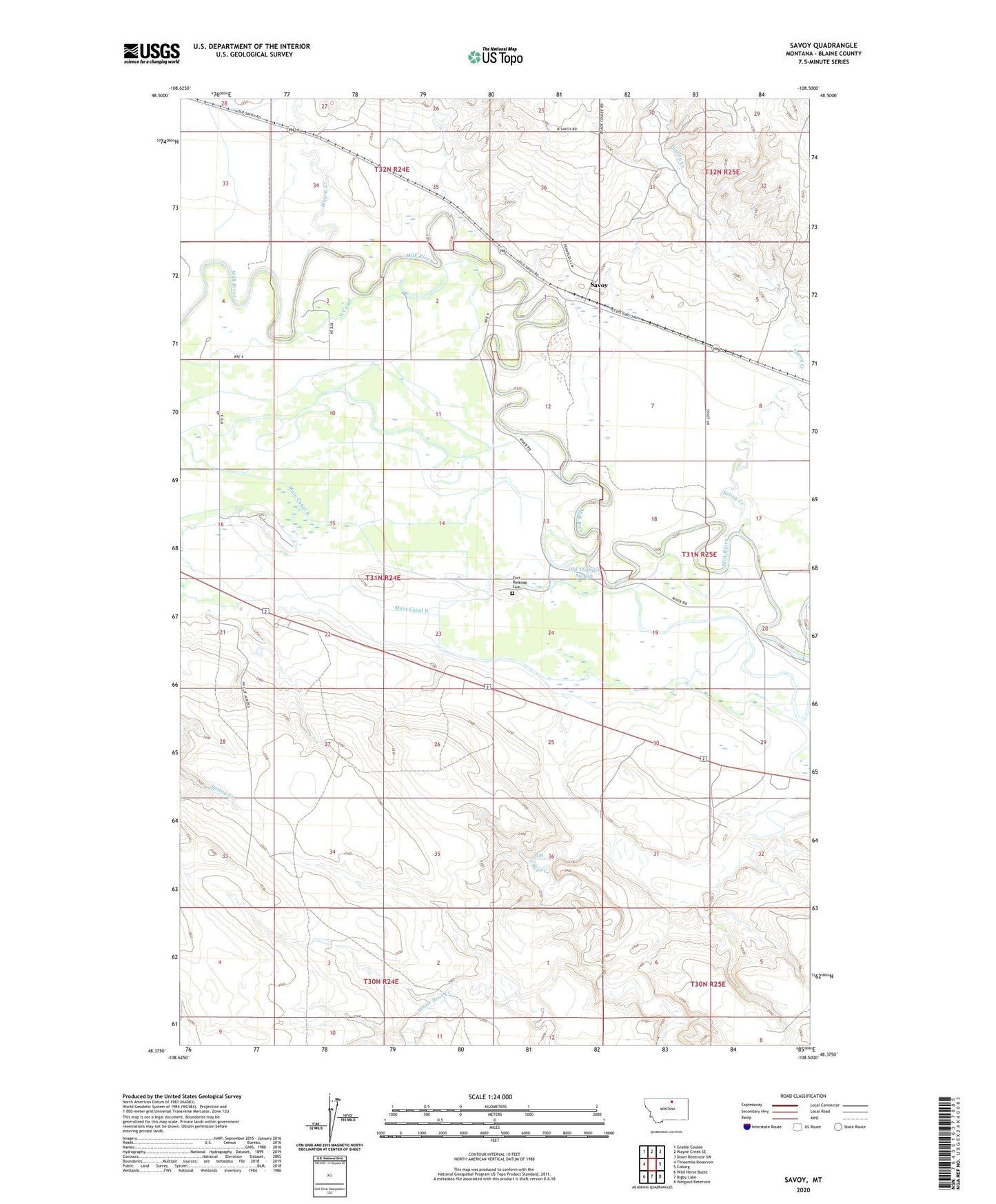
2024 topographic map quadrangle Savoy in the state of Montana. Scale: 1:24000. Based on the newly updated USGS 7.5' US Topo map series, this map is in the following counties: Blaine. The map contains contour data, water features, and other items you are used to seeing on USGS maps, but also has updated roads and other features. This is the next generation of topographic maps. Printed on high-quality waterproof paper with UV fade-resistant inks.
Quads adjacent to this one:
West: Threemile Reservoir
Northwest: Grable Coulee
North: Wayne Creek SE
Northeast: Down Reservoir SW
East: Coburg
Southeast: Weigand Reservoir
South: Bigby Lake
Southwest: Wild Horse Butte
This map covers the same area as the classic USGS quad with code o48108d5.
Contains the following named places: 31N24E02DAD_01 Well, 31N24E03CABC01 Well, 31N24E03CDBB01 Well, 31N24E03DCBC01 Well, 31N24E04CDC_01 Well, 31N24E09____01 Well, 31N24E13CAA_01 Well, 31N24E16ADC_01 Well, 31N24E16ADCD01 Well, 31N24E21ABDD01 Well, 31N24E21ACDA01 Well, 31N24E21CABA01 Well, 31N24E23AADC01 Well, 31N24E23DBCD01 Well, 31N24E23DCC_01 Well, 31N25E21CABA01 Well, Dogtown, Fort Belknap Cemetery, Main Canal B, McDaniels-Wolary School, Old Thunder Slough, Savoy, Savoy Catholic Church, Savoy Creek, Savoy Indian Day School, Savoy Post Office, Savoy Presbyterian Church, Savoy School, Wayne, Wayne Creek