MyTopo
Wayne Creek SE Montana US Topo Map
Couldn't load pickup availability
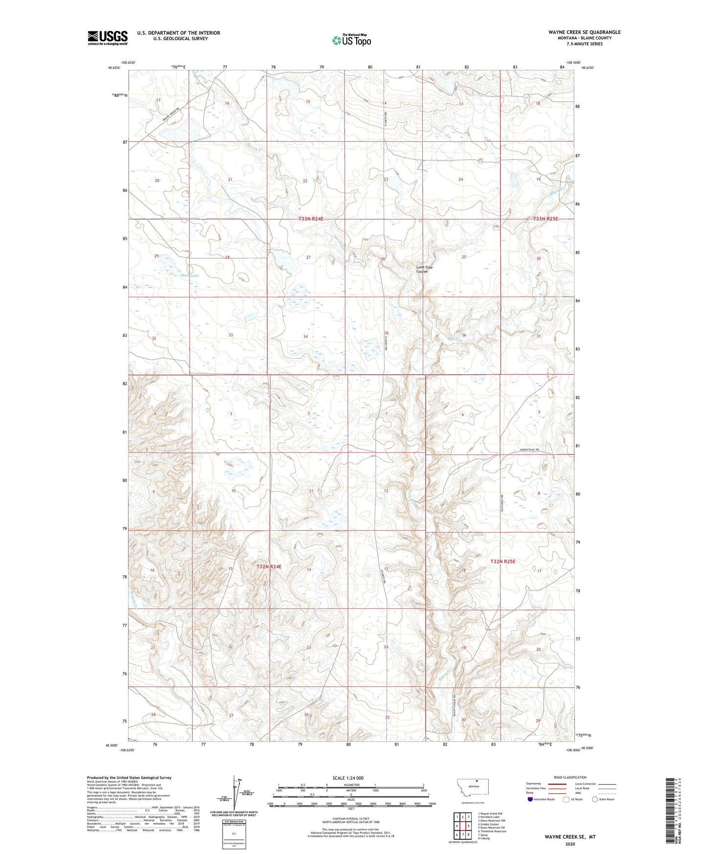
2024 topographic map quadrangle Wayne Creek SE in the state of Montana. Scale: 1:24000. Based on the newly updated USGS 7.5' US Topo map series, this map is in the following counties: Blaine. The map contains contour data, water features, and other items you are used to seeing on USGS maps, but also has updated roads and other features. This is the next generation of topographic maps. Printed on high-quality waterproof paper with UV fade-resistant inks.
Quads adjacent to this one:
West: Grable Coulee
Northwest: Wayne Creek NW
North: Hornbeck Lake
Northeast: Down Reservoir NW
East: Down Reservoir SW
Southeast: Coburg
South: Savoy
Southwest: Threemile Reservoir
This map covers the same area as the classic USGS quad with code o48108e5.
Contains the following named places: Black Creek, Grabtak Number 2 Dam, Hungover Dam, Lone Tree Coulee, Mohair Number 1 Dam, Mohair Number 2 Dam, Mud Lake, O'Leary School, Sam Dam, Sunny Dam, Terry Dam, Thee End Dam, Transistor Number 1 Dam, Transistor Number 2 Dam