MyTopo
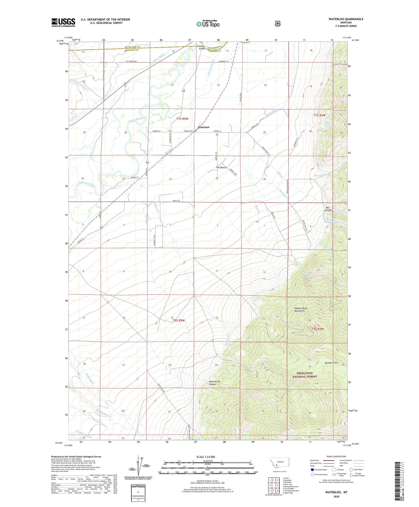
Waterloo Montana US Topo Map
Couldn't load pickup availability
Also explore the Waterloo Forest Service Topo of this same quad for updated USFS data
2024 topographic map quadrangle Waterloo in the state of Montana. Scale: 1:24000. Based on the newly updated USGS 7.5' US Topo map series, this map is in the following counties: Madison, Silver Bow, Jefferson. The map contains contour data, water features, and other items you are used to seeing on USGS maps, but also has updated roads and other features. This is the next generation of topographic maps. Printed on high-quality waterproof paper with UV fade-resistant inks.
Quads adjacent to this one:
West: Silver Star
Northwest: Grace
North: Vendome
Northeast: Whitehall
East: Manhead Mountain
Southeast: Noble Peak
South: Old Baldy Mountain
Southwest: Twin Bridges
This map covers the same area as the classic USGS quad with code o45112f2.
Contains the following named places: 01S05W26ADCC01 Well, 01S05W26DCD_01 Well, Antimony Creek, Beall Creek, Brooks Creek, Bumby Creek Mine, Bumby Gulch, Cornforth Ditch, Duffy Ditch, Hellroaring Canyon, Hulbert Creek, Little Cherry Creek, Little Spring Creek, Loomont, Loomont Post Office, Mill Canyon, Mill Creek, Mill Creek Mine, Ohio Lode Mine, Ohio Mine, Parrot Ditch, Parsons Bridge, Parsons Slough, River Side Ranch, Shaky Spring, Shaky Spring Mine, Silver Bow Ranch, Spring Creek, Strawn Mines, The Bench, Wagon Wheel Ranch, Waterloo, Waterloo Post Office, Waterloo School, White Rock Ranch, Wickham Creek