MyTopo
Grannis Montana US Topo Map
Couldn't load pickup availability
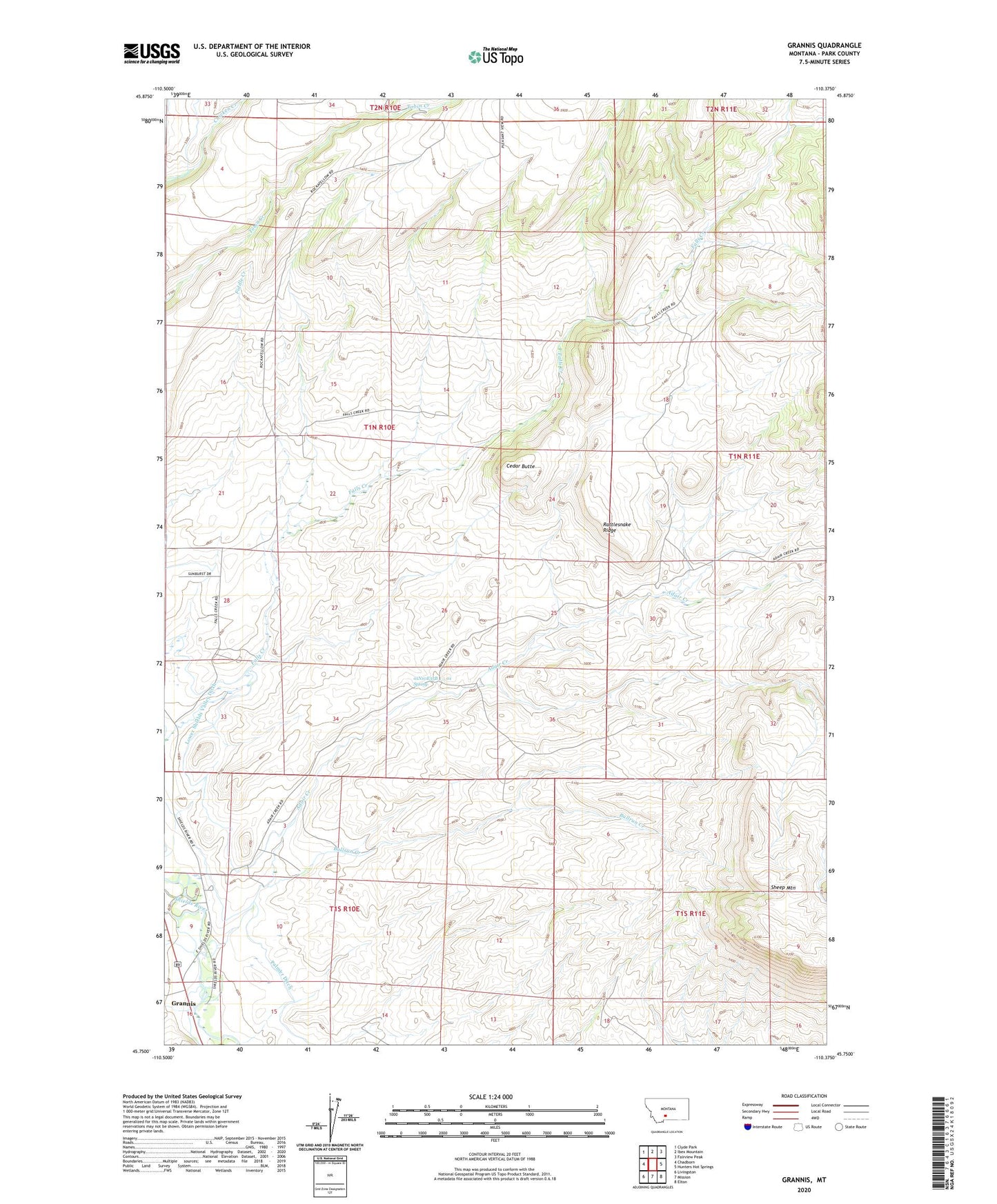
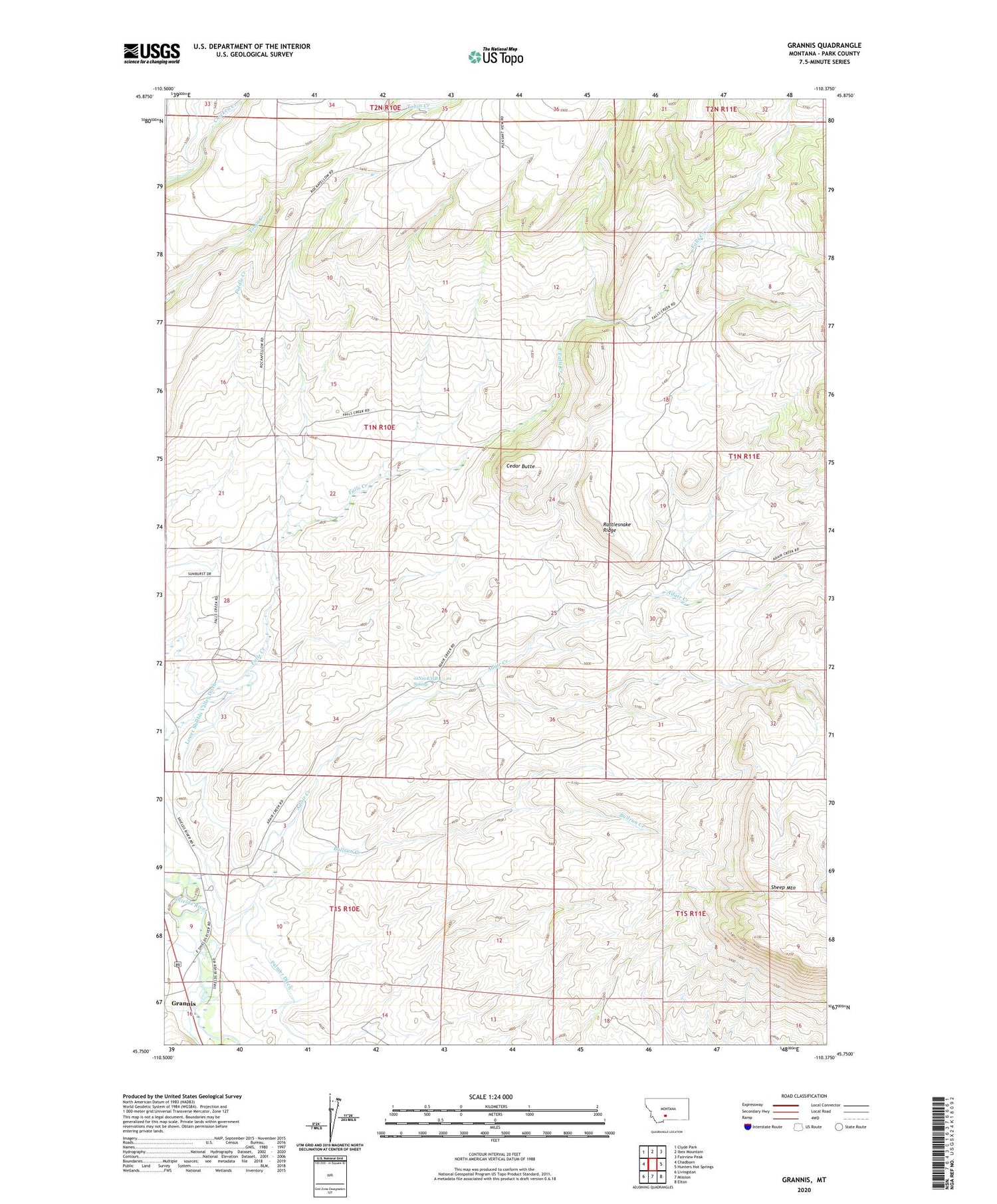
2020 topographic map quadrangle Grannis in the state of Montana. Scale: 1:24000. Based on the newly updated USGS 7.5' US Topo map series, this map is in the following counties: Park. The map contains contour data, water features, and other items you are used to seeing on USGS maps, but also has updated roads and other features. This is the next generation of topographic maps. Printed on high-quality waterproof paper with UV fade-resistant inks.
Quads adjacent to this one:
West: Chadborn
Northwest: Clyde Park
North: Ibex Mountain
Northeast: Fairview Peak
East: Hunters Hot Springs
Southeast: Elton
South: Mission
Southwest: Livingston
Contains the following named places: 01N10E22D___01 Well, 01N10E28B___01 Well, 01N10E35B___01 Spring, 01N10E36D___01 Well, 01S10E10B___01 Well, Adair Creek, Bohleen Ranch, Bonhomme Ranch, Bullrun Creek, Cedar Butte, Crazy Head Creek, Eyman Ranch, Falls Creek School, Grannis, Grannis School, Hetzel Ranch, Noel Creek, Palmer Ditch, Rattlesnake Ridge