
MyTopo
Grass Range Montana US Topo Map
Couldn't load pickup availability
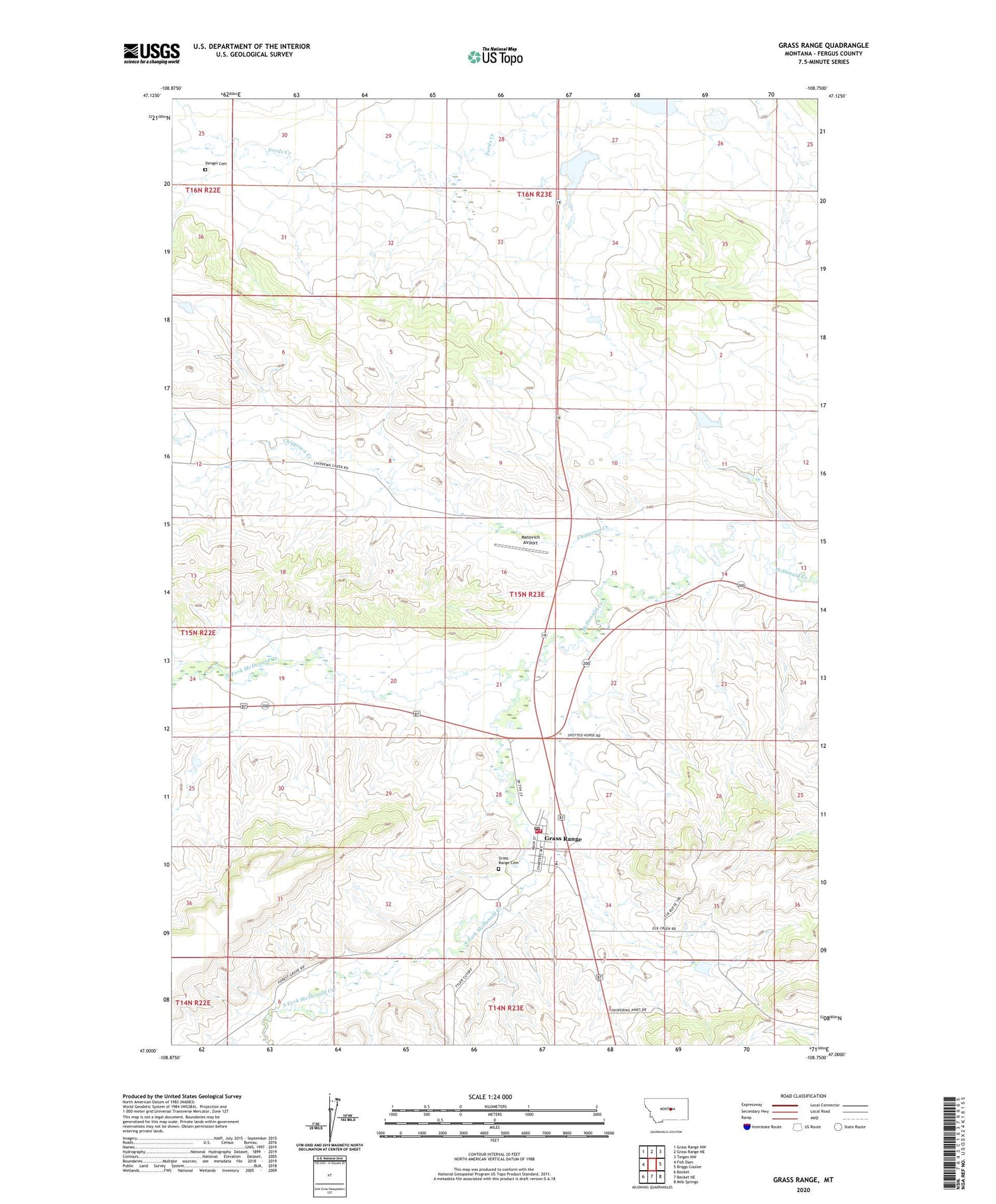
2020 topographic map quadrangle Grass Range in the state of Montana. Scale: 1:24000. Based on the newly updated USGS 7.5' US Topo map series, this map is in the following counties: Fergus. The map contains contour data, water features, and other items you are used to seeing on USGS maps, but also has updated roads and other features. This is the next generation of topographic maps. Printed on high-quality waterproof paper with UV fade-resistant inks.
Quads adjacent to this one:
West: Fish Dam
Northwest: Grass Range NW
North: Grass Range NE
Northeast: Teigen NW
East: Briggs Coulee
Southeast: Milk Springs
South: Becket NE
Southwest: Becket
Contains the following named places: 14N23E04ADA_01 Well, 15N22E12ADD_01 Well, 15N23E14BCA_01 Well, 15N23E22CBD_01 Well, American Lutheran Church, Arther Dengel Number 1 Dam, Chamberlain, Chippewa Creek, Dengel Cemetery, Dewry Dam, Grass Range, Grass Range Cemetery, Grass Range City Park, Grass Range Post Office, Grass Range Rural Fire Department, Grass Range School, Grass Range Volunteer Fire Department, Heble Dam, Jelly Bean Dam, Little Montana Truckstop Campground, Matovich Airport, Montana and Dakota Elevator, North Fork McDonald Creek, Saint Barbaras Catholic Church, South Fork McDonald Creek, Town of Grass Range, United Methodist Church


