MyTopo
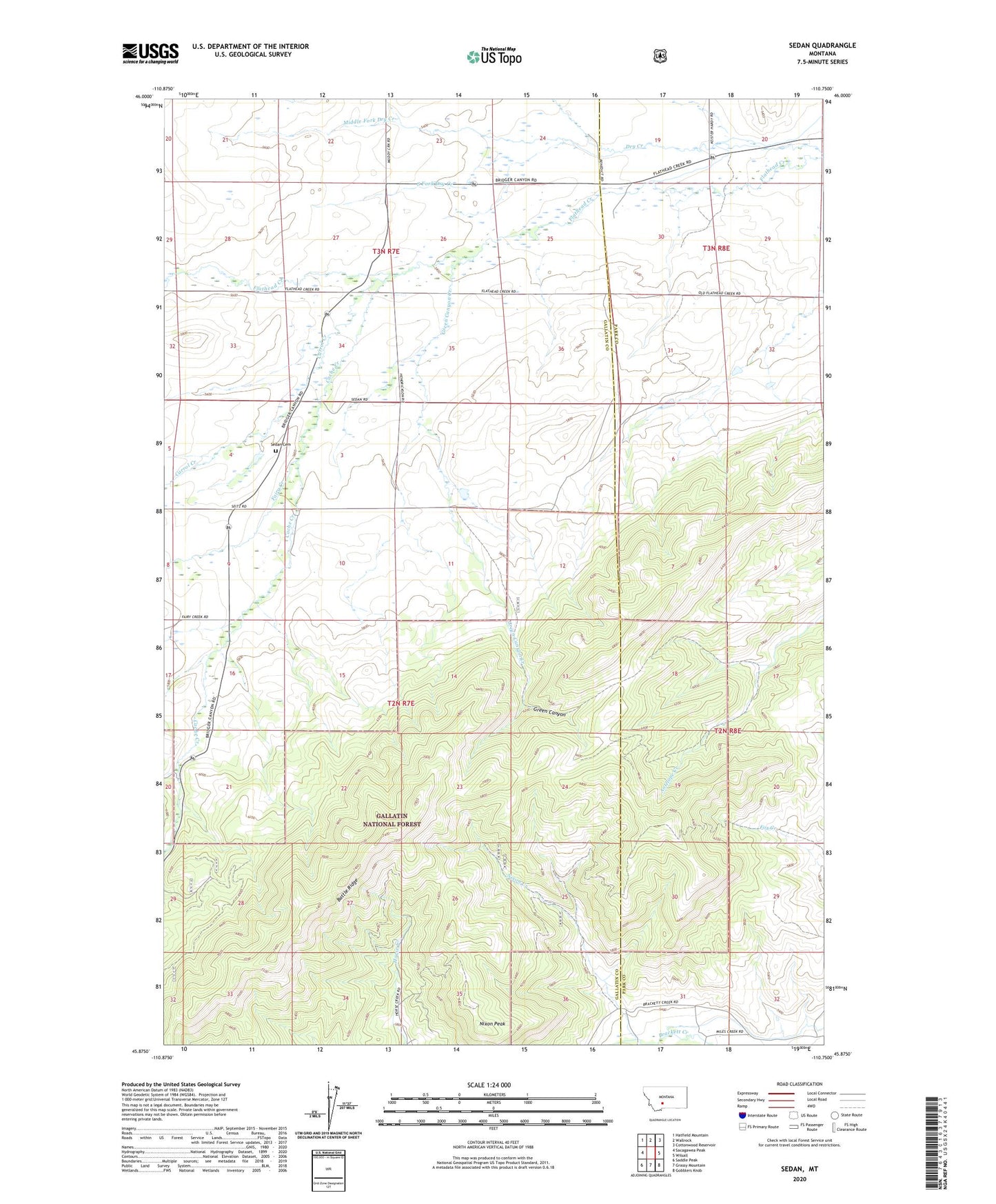
Sedan Montana US Topo Map
Couldn't load pickup availability
Also explore the Sedan Forest Service Topo of this same quad for updated USFS data
2024 topographic map quadrangle Sedan in the state of Montana. Scale: 1:24000. Based on the newly updated USGS 7.5' US Topo map series, this map is in the following counties: Gallatin, Park. The map contains contour data, water features, and other items you are used to seeing on USGS maps, but also has updated roads and other features. This is the next generation of topographic maps. Printed on high-quality waterproof paper with UV fade-resistant inks.
Quads adjacent to this one:
West: Sacagawea Peak
Northwest: Hatfield Mountain
North: Wallrock
Northeast: Cottonwood Reservoir
East: Wilsall
Southeast: Gobblers Knob
South: Grassy Mountain
Southwest: Saddle Peak
This map covers the same area as the classic USGS quad with code o45110h7.
Contains the following named places: 03N08E20C___01 Well, 03N08E20D___01 Well, 03N08E29D___01 Well, 03N08E31C___01 Well, Battle Ridge, Brackett Post Office, Cache Creek, Carrol Creek, Dry Creek, Fairy Creek, Green Canyon, Green Canyon Creek, Middle Fork Dry Creek, Nixon Creek, Nixon Peak, Sedan, Sedan Cemetery, Sedan Post Office, Sedan Rural Fire District, Sedan School, South Fork Dry Creek