MyTopo
Halbert Creek North Montana US Topo Map
Couldn't load pickup availability
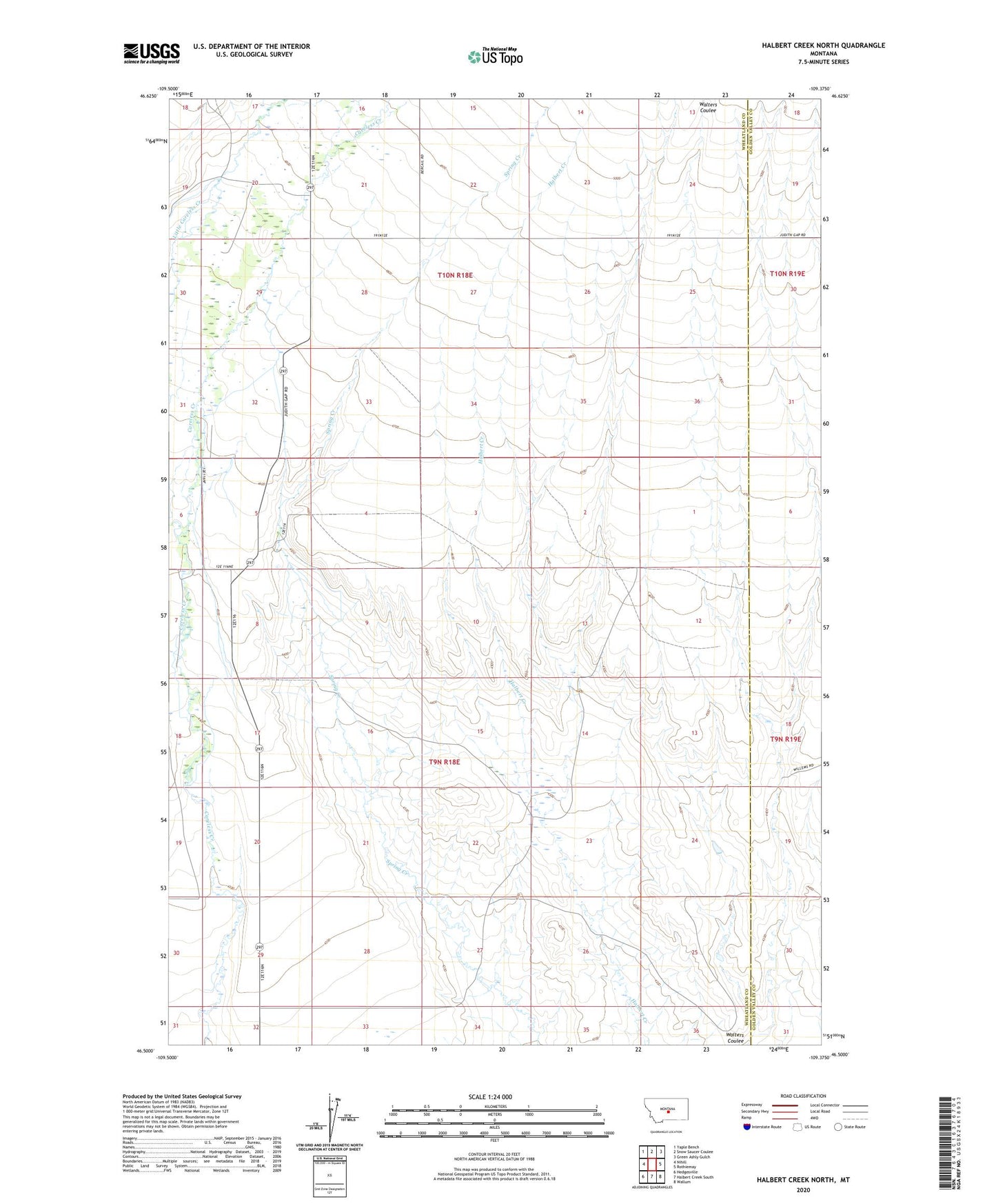
2024 topographic map quadrangle Halbert Creek North in the state of Montana. Scale: 1:24000. Based on the newly updated USGS 7.5' US Topo map series, this map is in the following counties: Wheatland, Golden Valley. The map contains contour data, water features, and other items you are used to seeing on USGS maps, but also has updated roads and other features. This is the next generation of topographic maps. Printed on high-quality waterproof paper with UV fade-resistant inks.
Quads adjacent to this one:
West: Nihill
Northwest: Yaple Bench
North: Snow Saucer Coulee
Northeast: Green Ashly Gulch
East: Rothiemay
Southeast: Wallum
South: Halbert Creek South
Southwest: Hedgesville
This map covers the same area as the classic USGS quad with code o46109e4.
Contains the following named places: Halbert Post Office, Little Careless Creek