MyTopo
Greenough Montana US Topo Map
Couldn't load pickup availability
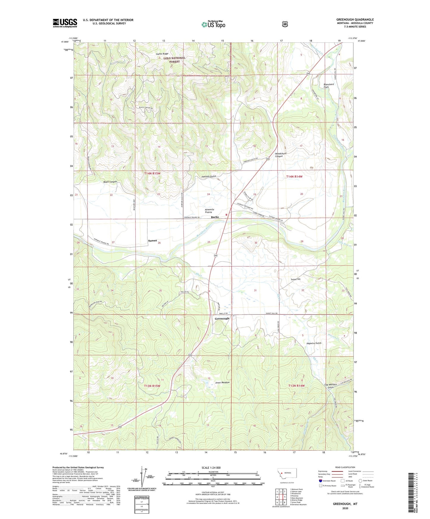
2020 topographic map quadrangle Greenough in the state of Montana. Scale: 1:24000. Based on the newly updated USGS 7.5' US Topo map series, this map is in the following counties: Missoula. The map contains contour data, water features, and other items you are used to seeing on USGS maps, but also has updated roads and other features. This is the next generation of topographic maps. Printed on high-quality waterproof paper with UV fade-resistant inks.
Quads adjacent to this one:
West: Potomac
Northwest: Belmont Point
North: Salmon Lake
Northeast: Woodworth
East: Bata Mountain
Southeast: Elevation Mountain
South: Union Peak
Southwest: Mineral Ridge
Contains the following named places: 13N14W06BCAB01 Well, 14N14W04BCCD01 Well, 14N14W04BDBD01 Well, 14N15W24DDAC01 Well, 14N15W24DDCD01 Well, Barite, Big Blackfoot Railroad Historical Marker, Black Canyon, Blanchard Creek, Cap Wallace Gulch, Clearwater River, Clearwater State Forest, Elk Creek, Fish Creek, Greenough, Greenough Post Office, Greenough Potomac Fire Station 2, Haywire Gulch, Hunter Point Lookout Tower, Jamison Gulch, Jones Meadow, Jones Meadow Dam, Little Fish Creek, Lubrecht Camp, Lubrecht Camp Ski Area, Lubrecht State Experimental Forest, Ninemile Prairie, Roundup Fishing Access Site, Stinkwater Creek, Sunset, Sunset Hill, Sunset School, Warren Creek, Woodchuck Canyon