MyTopo
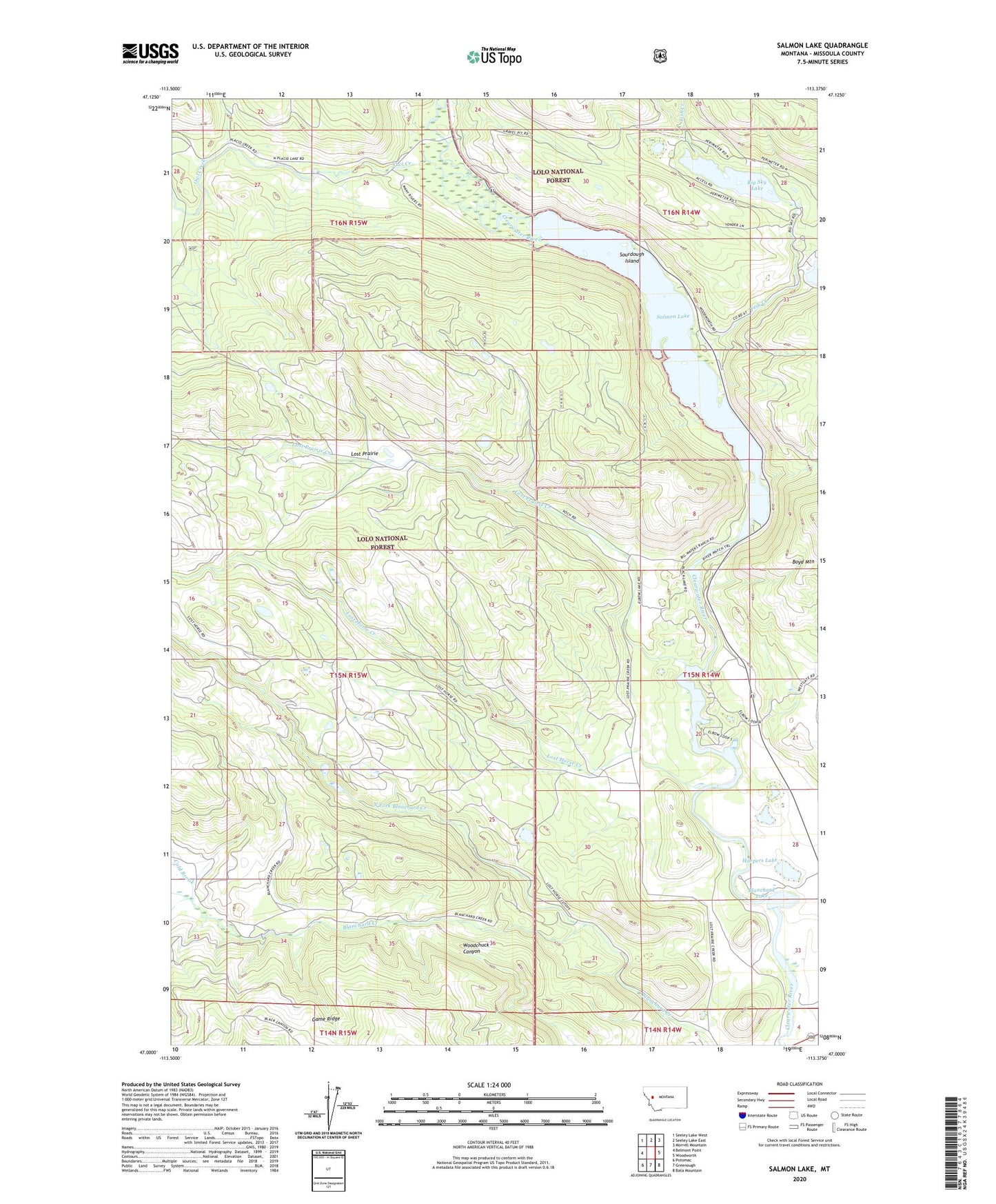
Salmon Lake Montana US Topo Map
Couldn't load pickup availability
Also explore the Salmon Lake Forest Service Topo of this same quad for updated USFS data
2024 topographic map quadrangle Salmon Lake in the state of Montana. Scale: 1:24000. Based on the newly updated USGS 7.5' US Topo map series, this map is in the following counties: Missoula. The map contains contour data, water features, and other items you are used to seeing on USGS maps, but also has updated roads and other features. This is the next generation of topographic maps. Printed on high-quality waterproof paper with UV fade-resistant inks.
Quads adjacent to this one:
West: Belmont Point
Northwest: Seeley Lake West
North: Seeley Lake East
Northeast: Morrell Mountain
East: Woodworth
Southeast: Bata Mountain
South: Greenough
Southwest: Potomac
This map covers the same area as the classic USGS quad with code o47113a4.
Contains the following named places: 15N14W05ABAB01 Well, 15N14W09BBCA01 Well, 15N14W09CBBC01 Well, Big Sky Lake, Blanchard Lake, Boyd Mountain, Clearwater, Clearwater Junction Fishing Access Site, Clearwater Post Office, Cold Brook, Elbow Lake, Fish Creek, Harpers Lake, Harpers Lake Fishing Access Site, Lost Horse Creek, Lost Prairie, Lost Prairie Creek, North Fork Blanchard Creek, Owl Creek, Saint Joseph Church, Salmon Lake, Salmon Lake Campground, Salmon Lake State Park, Sourdough Island, Sourdough Island on Salmon Lake Heliport