
MyTopo
Griffin Coulee NW Montana US Topo Map
Couldn't load pickup availability
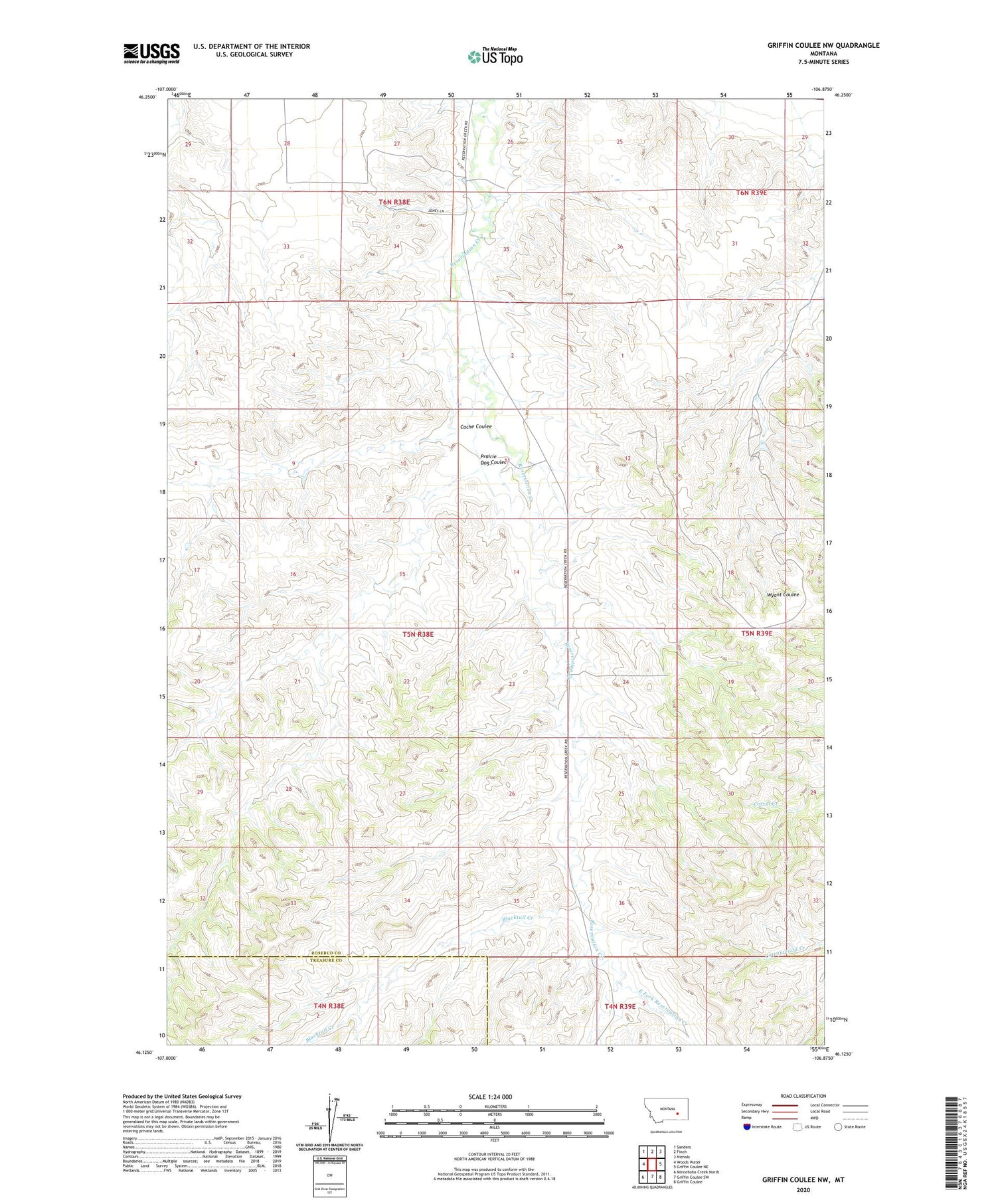
2020 topographic map quadrangle Griffin Coulee NW in the state of Montana. Scale: 1:24000. Based on the newly updated USGS 7.5' US Topo map series, this map is in the following counties: Rosebud, Treasure. The map contains contour data, water features, and other items you are used to seeing on USGS maps, but also has updated roads and other features. This is the next generation of topographic maps. Printed on high-quality waterproof paper with UV fade-resistant inks.
Quads adjacent to this one:
West: Woods Water
Northwest: Sanders
North: Finch
Northeast: Nichols
East: Griffin Coulee NE
Southeast: Griffin Coulee
South: Griffin Coulee SW
Southwest: Minnehaha Creek North
Contains the following named places: 05N38E14B___01 Well, 05N38E26DDDD01 Well, 05N46E15CBDD01 Well, Ash Grove School, Blacktail Creek, Cache Coulee, East Fork Reservation Creek, Pendlebury School, Prairie Dog Coulee, U M School


