MyTopo
Minnehaha Creek North Montana US Topo Map
Couldn't load pickup availability
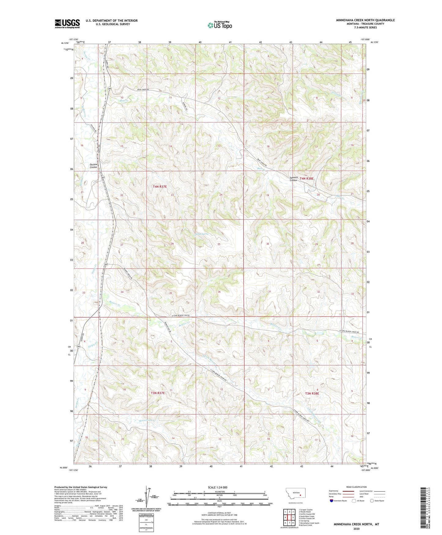
2024 topographic map quadrangle Minnehaha Creek North in the state of Montana. Scale: 1:24000. Based on the newly updated USGS 7.5' US Topo map series, this map is in the following counties: Treasure. The map contains contour data, water features, and other items you are used to seeing on USGS maps, but also has updated roads and other features. This is the next generation of topographic maps. Printed on high-quality waterproof paper with UV fade-resistant inks.
Quads adjacent to this one:
West: South Bear Creek
Northwest: Scraper Coulee
North: Woods Water
Northeast: Griffin Coulee NW
East: Griffin Coulee SW
Southeast: McClure Creek
South: Minnehaha Creek South
Southwest: Iron Spring
This map covers the same area as the classic USGS quad with code o46107a1.
Contains the following named places: 03N37E02DDAB01 Well, 03N37E03CBBD01 Well, 03N37E09A___01 Well, 03N37E09ACCB01 Spring, 03N37E09DDDD01 Well, 03N37E10ACCB01 Well, 04N37E22BAAD01 Well, 04N37E27CACA01 Well, 04N38E20BDCC01 Well, Bear Creek, Beaver Creek, Beaver Creek School, Bob, Clark School, Crystal Creek, Dick Post Office, Minnehaha Creek, Movius School, Outlaw Coulee, Outlaw Spring, Petersen Ranch, Rumsey Post Office, Sawmill Coulee, South Bear Creek, South Fork Beaver Creek, West Bear Creek, Wheelock School