
MyTopo
Grosfield Ranch Montana US Topo Map
Couldn't load pickup availability
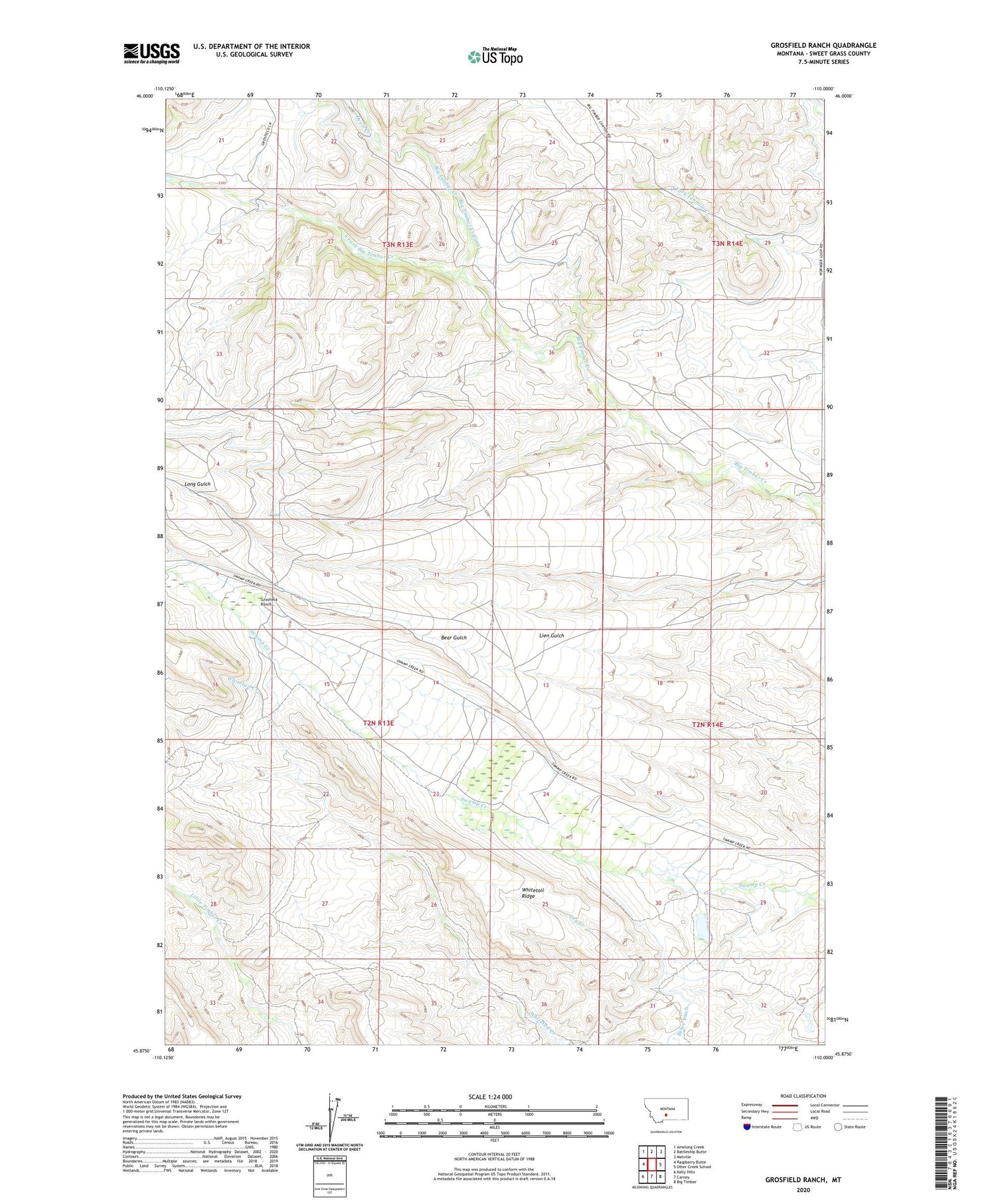
2020 topographic map quadrangle Grosfield Ranch in the state of Montana. Scale: 1:24000. Based on the newly updated USGS 7.5' US Topo map series, this map is in the following counties: Sweet Grass. The map contains contour data, water features, and other items you are used to seeing on USGS maps, but also has updated roads and other features. This is the next generation of topographic maps. Printed on high-quality waterproof paper with UV fade-resistant inks.
Quads adjacent to this one:
West: Raspberry Butte
Northwest: Amelong Creek
North: Battleship Butte
Northeast: Melville
East: Otter Creek School
Southeast: Big Timber
South: Carney
Southwest: Kelly Hills
Contains the following named places: 02N13E14____01 Well, 02N14E05____01 Well, 02N14E30____01 Well, 03N13E25____01 Well, 03N14E29____01 Well, Buffalo Jump Ranch, Burns Dam, Devil Creek, Grosfield Ranch, Hauge Homestead, Hegdal Homestead, Iverson Homestead, John Nelson Homestead, Langus Homestead, Plaggemeyer Homestead, South Fork Big Timber Creek, Tintinger Homestead, Vik Homestead, Whitetail Ridge, Whitney Ranch, Wormser, Wormser Post Office, Wormser School


