MyTopo
Battleship Butte Montana US Topo Map
Couldn't load pickup availability
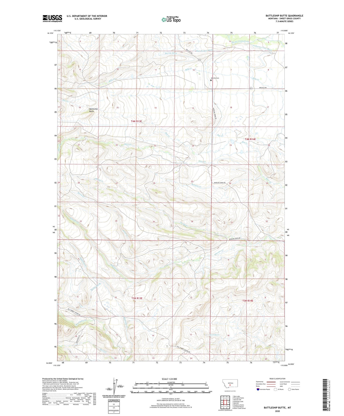
2024 topographic map quadrangle Battleship Butte in the state of Montana. Scale: 1:24000. Based on the newly updated USGS 7.5' US Topo map series, this map is in the following counties: Sweet Grass. The map contains contour data, water features, and other items you are used to seeing on USGS maps, but also has updated roads and other features. This is the next generation of topographic maps. Printed on high-quality waterproof paper with UV fade-resistant inks.
Quads adjacent to this one:
West: Amelong Creek
Northwest: Rein Lake
North: Porcupine Butte
Northeast: Melville NW
East: Melville
Southeast: Otter Creek School
South: Grosfield Ranch
Southwest: Raspberry Butte
This map covers the same area as the classic USGS quad with code o46110a1.
Contains the following named places: 04N14E05____01 Well, 04N14E07____01 Well, 04N14E18____01 Well, 04N14E20____01 Well, Anderson Vose Ditch, Battleship Butte, Billy Creek, Bologne Creek, Dry Creek, Hailstone Creek, Hart Parker Ditch, Horse Creek, Melville Cemetery, Melville Church, Spring Creek, Stevens Number 1 Dam, Stocker Ditch