MyTopo
Melville Montana US Topo Map
Couldn't load pickup availability
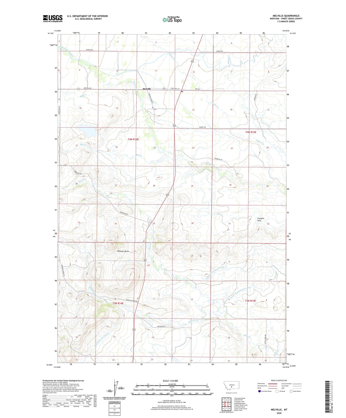
2024 topographic map quadrangle Melville in the state of Montana. Scale: 1:24000. Based on the newly updated USGS 7.5' US Topo map series, this map is in the following counties: Sweet Grass. The map contains contour data, water features, and other items you are used to seeing on USGS maps, but also has updated roads and other features. This is the next generation of topographic maps. Printed on high-quality waterproof paper with UV fade-resistant inks.
Quads adjacent to this one:
West: Battleship Butte
Northwest: Porcupine Butte
North: Melville NW
Northeast: Gougley Creek
East: Upper Glaston Lake
Southeast: Ryan Creek
South: Otter Creek School
Southwest: Grosfield Ranch
This map covers the same area as the classic USGS quad with code o46109a8.
Contains the following named places: 03N14E09DCC_01 Well, 03N15E08____01 Well, 03N15E17____01 Well, 04N14E14BA__01 Well, 04N14E15____01 Well, 04N15E17____01 Well, Alkali Creek, Cramer Dam, Franklin Hills, Glasston Post Office, Melville, Melville Post Office, Melville School, Norwegian Settlement, Puett Post Office, Rye Creek, Upper Sweet Grass Canal, Wheeler Butte, Wheeler Creek