MyTopo
Hardin SW Montana US Topo Map
Couldn't load pickup availability
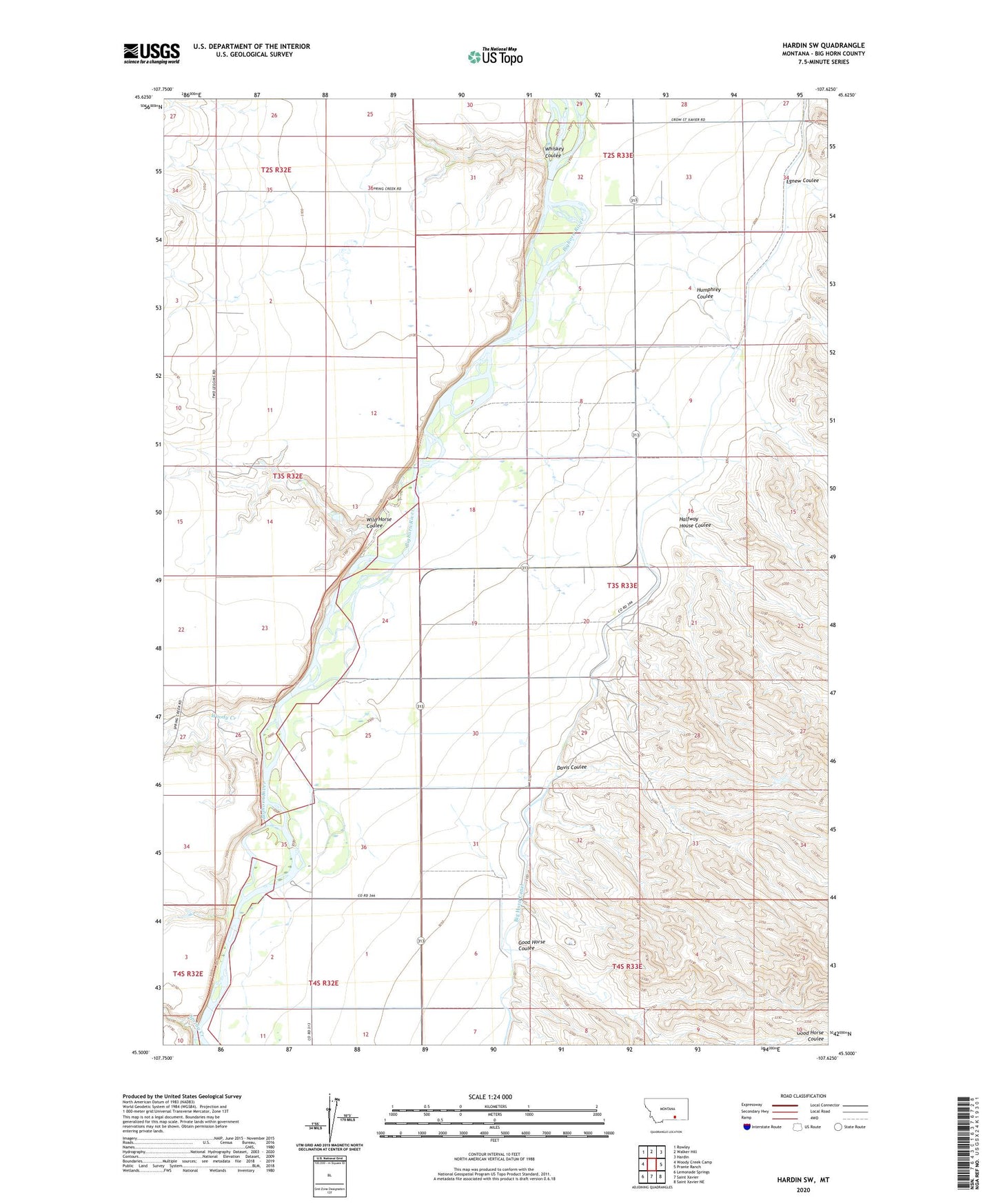
2024 topographic map quadrangle Hardin SW in the state of Montana. Scale: 1:24000. Based on the newly updated USGS 7.5' US Topo map series, this map is in the following counties: Big Horn. The map contains contour data, water features, and other items you are used to seeing on USGS maps, but also has updated roads and other features. This is the next generation of topographic maps. Printed on high-quality waterproof paper with UV fade-resistant inks.
Quads adjacent to this one:
West: Woody Creek Camp
Northwest: Rowley
North: Walker Hill
Northeast: Hardin
East: Prante Ranch
Southeast: Saint Xavier NE
South: Saint Xavier
Southwest: Lemonade Springs
This map covers the same area as the classic USGS quad with code o45107e6.
Contains the following named places: 03S33E08BDD_01 Well, 03S33E09DCC_01 Well, 03S33E16BBBB01 Well, 03S33E16BBBB02 Well, 03S33E31CCCC01 Well, 04S32E02AAA_01 Well, Crow Number 24 Dam, Davis Coulee, Egnew Coulee, Good Horse Coulee, Halfway House Coulee, Halfway School, Humphrey Coulee, Kopac Camp, Mallards Landing Fishing Access Site, Spring Creek, Whiskey Coulee, Wild Horse Coulee, Woody Creek