MyTopo
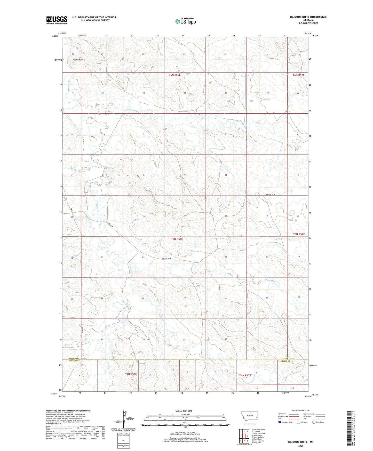
Harmon Butte Montana US Topo Map
Couldn't load pickup availability
2024 topographic map quadrangle Harmon Butte in the state of Montana. Scale: 1:24000. Based on the newly updated USGS 7.5' US Topo map series, this map is in the following counties: Fallon, Carter. The map contains contour data, water features, and other items you are used to seeing on USGS maps, but also has updated roads and other features. This is the next generation of topographic maps. Printed on high-quality waterproof paper with UV fade-resistant inks.
Quads adjacent to this one:
West: Nelson Butte
Northwest: Bracket Butte SE
North: T G Creek
Northeast: Little Pine Creek
East: Seven-up Butte
Southeast: Piney Butte
South: Piney Butte SW
Southwest: Skunk Creek
This map covers the same area as the classic USGS quad with code o46104b6.
Contains the following named places: 05N56E02BB__01 Well, 05N56E04BCB_01 Well, 05N56E08BA__01 Well, 05N56E17DD__01 Well, 05N56E22DABB01 Well, 05N56E22DB__01 Well, 05N56E22DC__01 Well, 05N56E24ABBB01 Well, 05N56E24ADAD01 Well, 05N56E31DAD_01 Well, 05N56E32CBB_01 Well, 05N56E36BAB_01 Well, 05N57E18BAAB01 Well, 7-UP Sea Dam, Ash Creek, Harmon Butte, Lame Jones Creek, Lone Tree Creek, MacKenzie, MacKenzie Post Office, McLean, Mile Creek, Milk Creek, South Fork Milk Creek, Spring Creek