MyTopo
T G Creek Montana US Topo Map
Couldn't load pickup availability
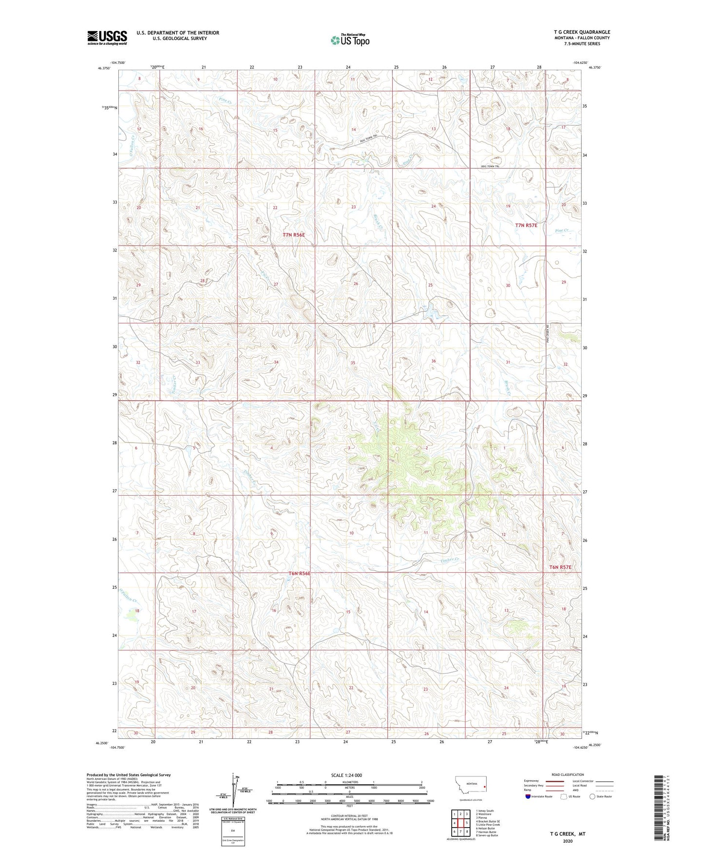
2024 topographic map quadrangle T G Creek in the state of Montana. Scale: 1:24000. Based on the newly updated USGS 7.5' US Topo map series, this map is in the following counties: Fallon. The map contains contour data, water features, and other items you are used to seeing on USGS maps, but also has updated roads and other features. This is the next generation of topographic maps. Printed on high-quality waterproof paper with UV fade-resistant inks.
Quads adjacent to this one:
West: Bracket Butte SE
Northwest: Ismay South
North: Westmore
Northeast: Plevna
East: Little Pine Creek
Southeast: Seven-up Butte
South: Harmon Butte
Southwest: Nelson Butte
This map covers the same area as the classic USGS quad with code o46104c6.
Contains the following named places: 06N56E02BA__01 Well, 06N56E10DC__01 Well, 06N56E23AB__01 Well, 06N57E06CCB_01 Well, 07N56E14DC__02 Well, 07N56E14DCAC01 Well, 07N56E25CDB_01 Well, 07N57E31BB__01 Well, Askin Dam, Brush Creek, T G Creek