MyTopo
Nelson Butte Montana US Topo Map
Couldn't load pickup availability
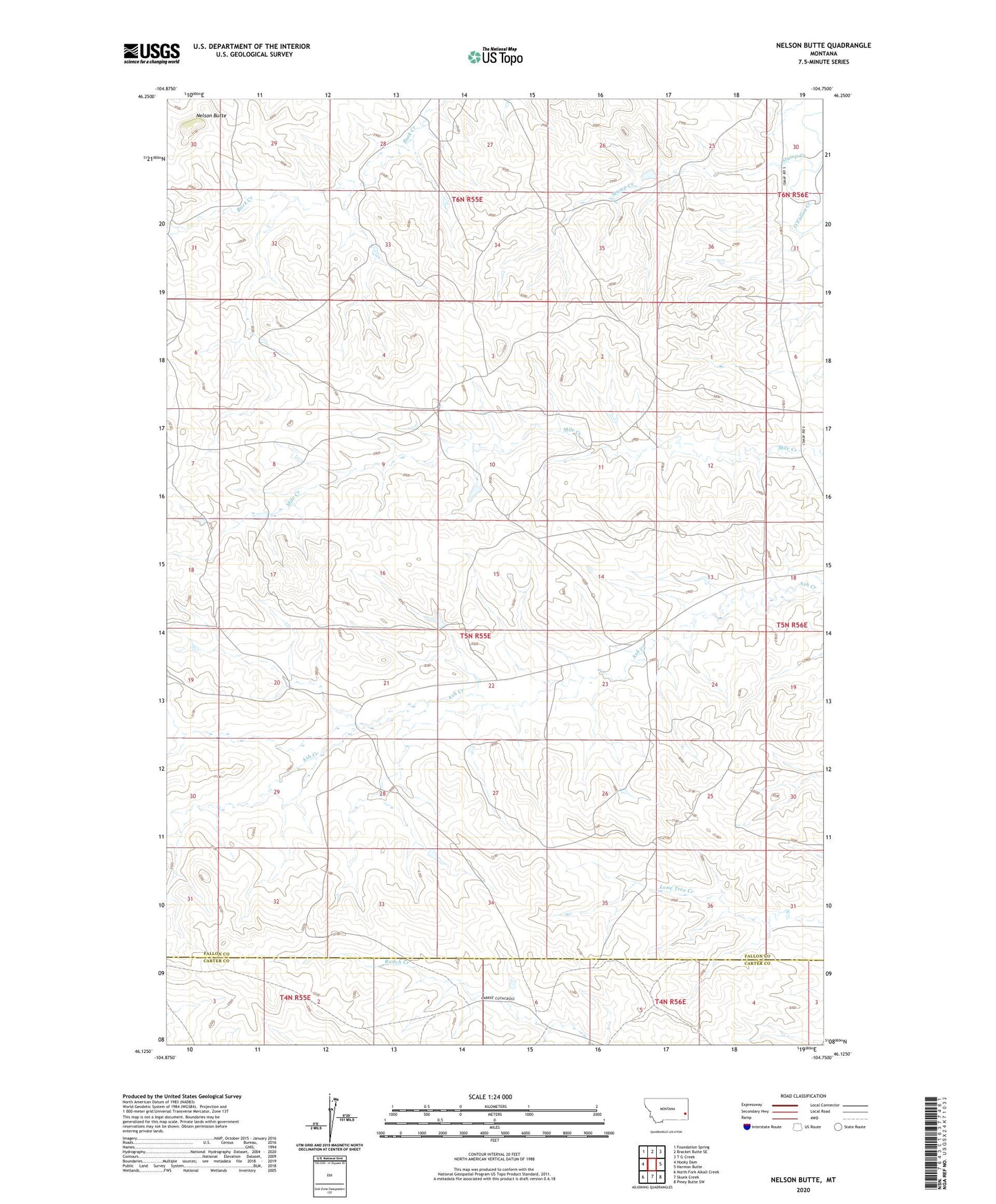
2024 topographic map quadrangle Nelson Butte in the state of Montana. Scale: 1:24000. Based on the newly updated USGS 7.5' US Topo map series, this map is in the following counties: Fallon, Carter. The map contains contour data, water features, and other items you are used to seeing on USGS maps, but also has updated roads and other features. This is the next generation of topographic maps. Printed on high-quality waterproof paper with UV fade-resistant inks.
Quads adjacent to this one:
West: Hooky Dam
Northwest: Foundation Spring
North: Bracket Butte SE
Northeast: T G Creek
East: Harmon Butte
Southeast: Piney Butte SW
South: Skunk Creek
Southwest: North Fork Alkali Creek
This map covers the same area as the classic USGS quad with code o46104b7.
Contains the following named places: 04N55E04DAA_01 Well, 05N55E11AC__01 Well, 05N55E13CC__01 Well, 05N55E13DAD_01 Well, 05N55E18CDC_01 Well, 05N55E21CCCC01 Well, 05N55E23AADB01 Well, 05N55E23BD__01 Well, 05N55E27BD__01 Well, 05N55E35ADAD01 Well, 05N56E07BBC_01 Well, 06N55E26BBBB01 Well, 06N56E31BC__01 Well, 06N56E31CC__01 Well, Nelson Butte, Stump Creek