MyTopo
Haystack Peak Montana US Topo Map
Couldn't load pickup availability
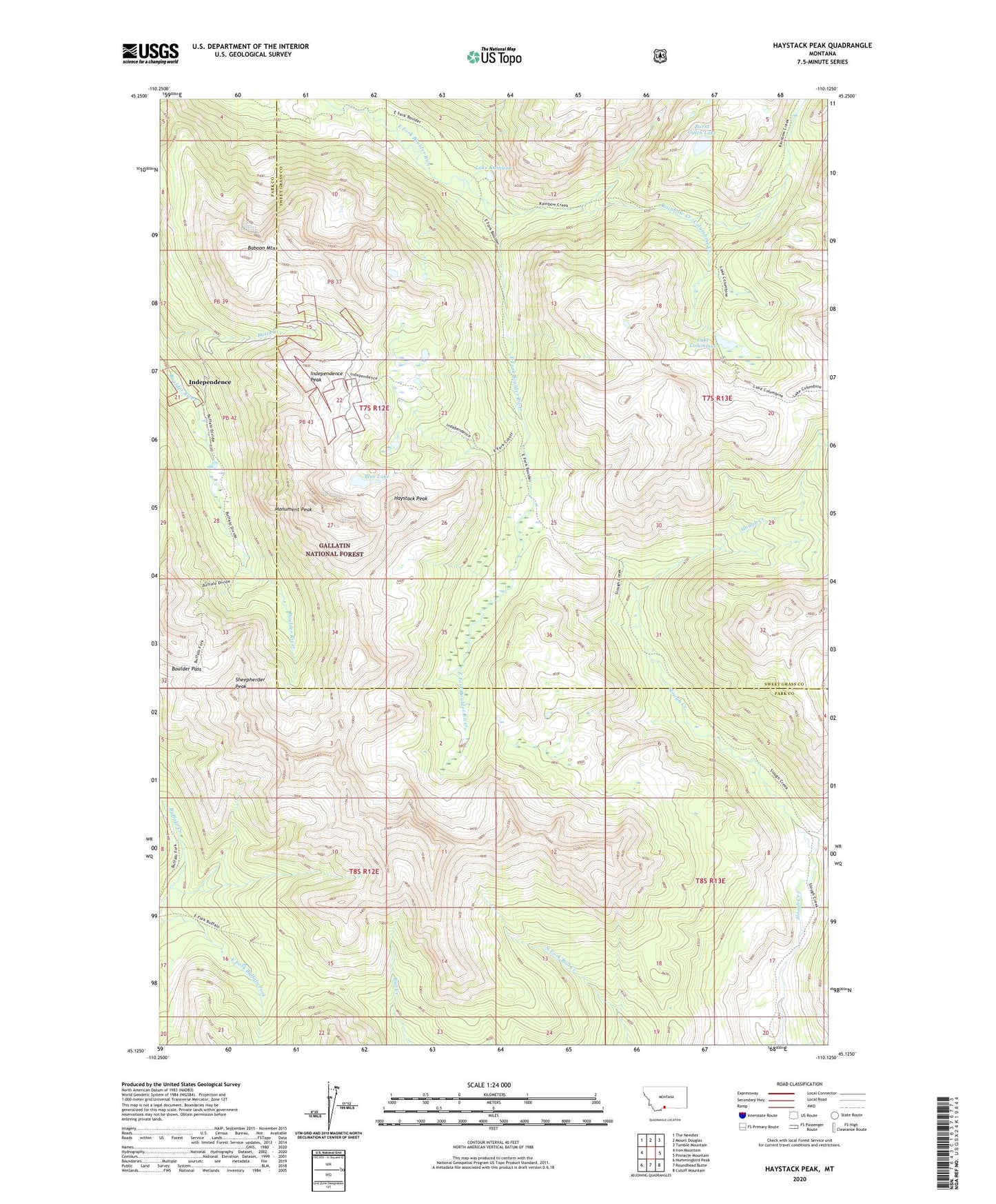
2020 topographic map quadrangle Haystack Peak in the state of Montana. Scale: 1:24000. Based on the newly updated USGS 7.5' US Topo map series, this map is in the following counties: Park, Sweet Grass. The map contains contour data, water features, and other items you are used to seeing on USGS maps, but also has updated roads and other features. This is the next generation of topographic maps. Printed on high-quality waterproof paper with UV fade-resistant inks.
Quads adjacent to this one:
West: Iron Mountain
Northwest: The Needles
North: Mount Douglas
Northeast: Tumble Mountain
East: Pinnacle Mountain
Southeast: Cutoff Mountain
South: Roundhead Butte
Southwest: Hummingbird Peak
Contains the following named places: Baboon Mountain, Blue Lake, Boulder Pass, Burnt Gulch Lake, Columbine Creek, Columbine Peak, Crown Mine, Delta Mine, Haystack Peak, Hidden Treasure Mine, Independence, Independence A Mine, Independence Mine, Independence Peak, Independence Post Office, Lake Columbine, Lake Kathleen, Monument Peak, NW Section 22 Mine, Omega Mine, Poor Man Number 2 Mine, Poor Man/Emma Mine, Rainbow Creek, SE Section 22 Mine, Sheepherder Peak, Solomon City, Wounded Man Creek, Yager/Daisy Mine