MyTopo
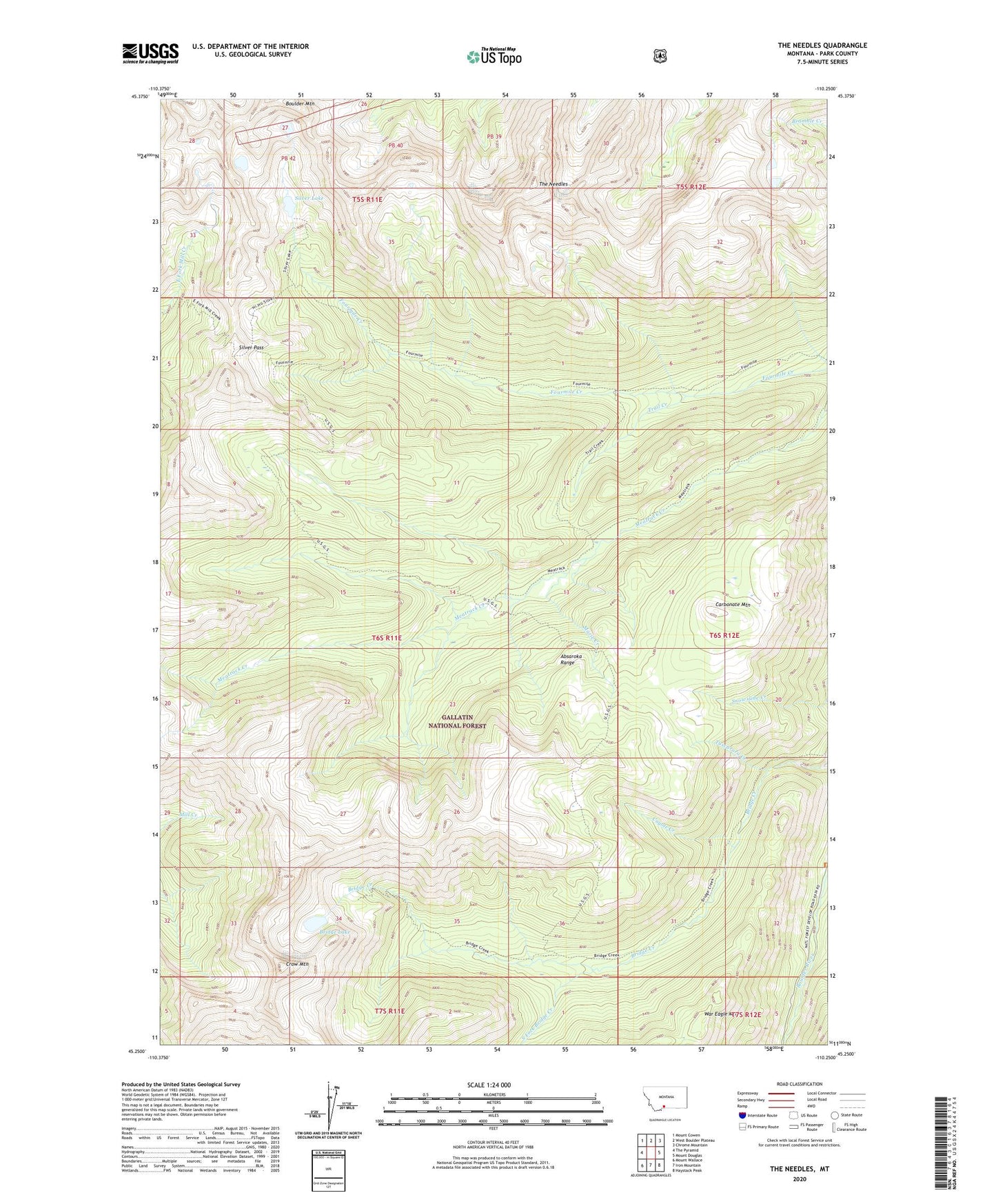
The Needles Montana US Topo Map
Couldn't load pickup availability
Also explore the The Needles Forest Service Topo of this same quad for updated USFS data
2024 topographic map quadrangle The Needles in the state of Montana. Scale: 1:24000. Based on the newly updated USGS 7.5' US Topo map series, this map is in the following counties: Park. The map contains contour data, water features, and other items you are used to seeing on USGS maps, but also has updated roads and other features. This is the next generation of topographic maps. Printed on high-quality waterproof paper with UV fade-resistant inks.
Quads adjacent to this one:
West: The Pyramid
Northwest: Mount Cowen
North: West Boulder Plateau
Northeast: Chrome Mountain
East: Mount Douglas
Southeast: Haystack Peak
South: Iron Mountain
Southwest: Mount Wallace
This map covers the same area as the classic USGS quad with code o45110c3.
Contains the following named places: Bridge Lake, Carbonate Mountain, Coyote Creek, Crow Mountain, Gallatin National Forest, Marie Creek, Silver Lake, Silver Pass, South Fork Bridge Creek, The Needles, Trail Creek, Tuscarora Creek, War Eagle Mountain