MyTopo
Stratton Reservoir Montana US Topo Map
Couldn't load pickup availability
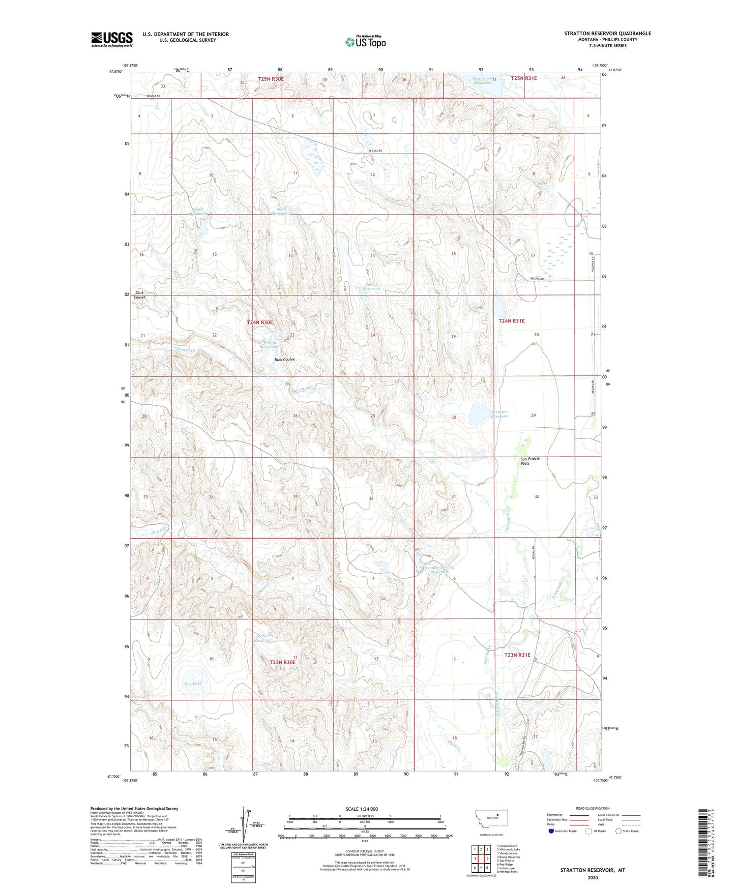
2024 topographic map quadrangle Stratton Reservoir in the state of Montana. Scale: 1:24000. Based on the newly updated USGS 7.5' US Topo map series, this map is in the following counties: Phillips. The map contains contour data, water features, and other items you are used to seeing on USGS maps, but also has updated roads and other features. This is the next generation of topographic maps. Printed on high-quality waterproof paper with UV fade-resistant inks.
Quads adjacent to this one:
West: Dione Reservoir
Northwest: Emond Ranch
North: Whitcomb Lake
Northeast: Sheep Coulee
East: Sun Prairie
Southeast: Herman Point
South: Indian Lake
Southwest: Pea Ridge
This map covers the same area as the classic USGS quad with code o47107g7.
Contains the following named places: 23N31E05AA__01 Well, 23N31E05CA__01 Well, 24N31E29DAC_01 Well, 24N31E30AB__01 Well, Barnard Dam, Dry Lake, First Creek, First Creek Community Center, King Reservoir, King Reservoir Dam, Koss Number 3 Dam, McNeil Reservoir, Number Twenty Reservoir, Number Twenty Reservoir Dam, Prairie Union School, R Ereaux Number 1 Dam, Salene Reservoir, Second Creek, Skull Reservoir, Stratton Reservoir, Tank Coulee, Wilson Reservoir