MyTopo
Indian Lake Montana US Topo Map
Couldn't load pickup availability
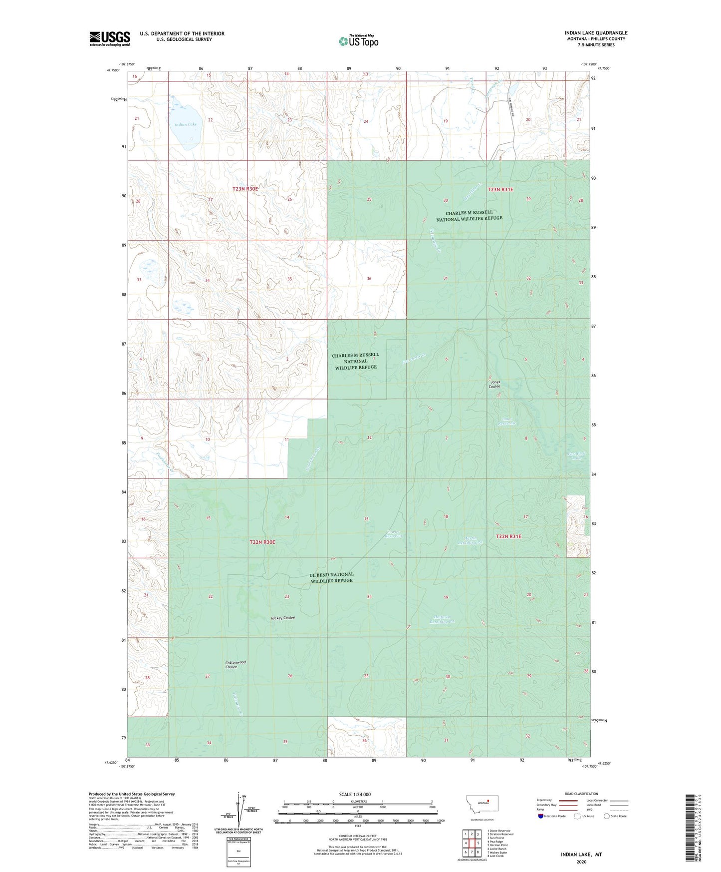
2024 topographic map quadrangle Indian Lake in the state of Montana. Scale: 1:24000. Based on the newly updated USGS 7.5' US Topo map series, this map is in the following counties: Phillips. The map contains contour data, water features, and other items you are used to seeing on USGS maps, but also has updated roads and other features. This is the next generation of topographic maps. Printed on high-quality waterproof paper with UV fade-resistant inks.
Quads adjacent to this one:
West: Pea Ridge
Northwest: Dione Reservoir
North: Stratton Reservoir
Northeast: Sun Prairie
East: Herman Point
Southeast: Lost Creek
South: Mickey Butte
Southwest: Locke Ranch
This map covers the same area as the classic USGS quad with code o47107f7.
Contains the following named places: 22N30E09AC__01 Well, 22N30E23BB__01 Well, 22N30E28AD__01 Well, 22N31E07BC__01 Well, Box Elder Creek, CCC Indian Division Number 1 Dam, Cottonwood Coulee, Fourchette Creek, Fowler Reservoir, Fowler Reservoir Dam, Halfway Retaining Pit, Indian Lake, Jones Coulee, Jones Reservoir, Long X Ranch, Long X School, Martin Retaining Pit, Matovich Ranch, Mickey Coulee, Stratton School, Telegraph Creek, Third Creek, Valentine Creek, Wiederrick Dam, Wiederrick Ranch, X Crossing