MyTopo
Hodges Montana US Topo Map
Couldn't load pickup availability
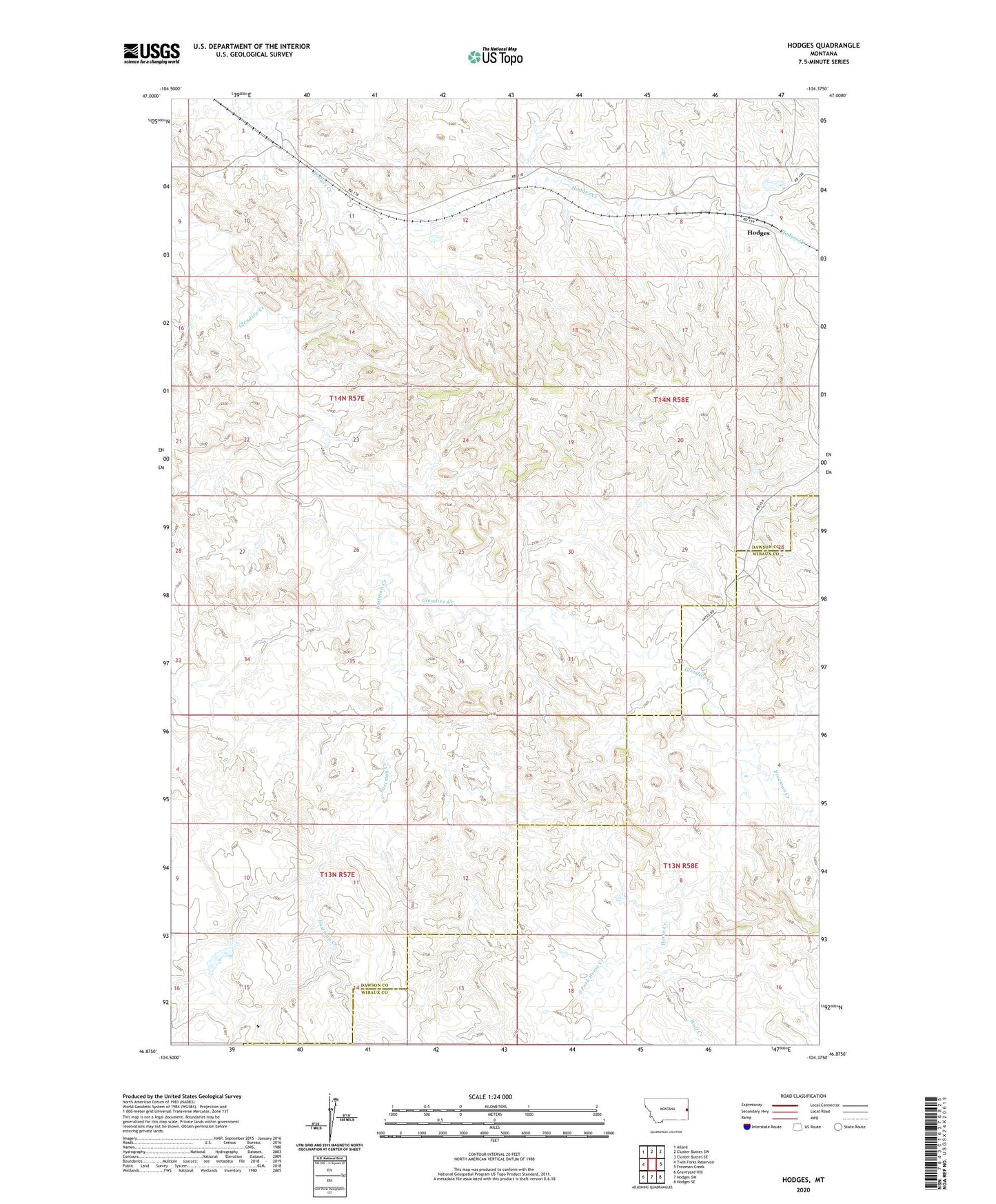
2024 topographic map quadrangle Hodges in the state of Montana. Scale: 1:24000. Based on the newly updated USGS 7.5' US Topo map series, this map is in the following counties: Dawson, Wibaux. The map contains contour data, water features, and other items you are used to seeing on USGS maps, but also has updated roads and other features. This is the next generation of topographic maps. Printed on high-quality waterproof paper with UV fade-resistant inks.
Quads adjacent to this one:
West: Twin Forks Reservoir
Northwest: Allard
North: Cluster Buttes SW
Northeast: Cluster Buttes SE
East: Freeman Creek
Southeast: Hodges SE
South: Hodges SW
Southwest: Graveyard Hill
This map covers the same area as the classic USGS quad with code o46104h4.
Contains the following named places: 14N57E15B___01 Well, 14N58E09BBDA01 Well, Eastman Creek, Freeman Creek, Hodges, Hodges Post Office, Hodges School, Horse Creek, Iona, J C Kinney Elevator, Jonas Number 6 Dam, Long Siding, South Fork Horse Creek, Wolf Creek